2026:110 - Doohamlat, Castleblayney, Monaghan
County: Monaghan
Site name: Doohamlat, Castleblayney
Sites and Monuments Record No.: N/A
Licence number: 26E0323
Author: Michael Greiner & Seán Shanahan; Shanarc Archaeology Ltd.
Author/Organisation Address: Unit 39A, Hebron Business Park, Hebron Road, Kilkenny
Site type: Pit/hearth & possible kiln
Period/Dating: Undetermined
ITM: E 676637m, N 820660m
Latitude, Longitude (decimal degrees): 54.129256, -6.827450
Archaeological test-excavations were carried out, on 11 May 2026, as part of an AIA relating to the proposed construction of a residential housing development at Doohamlat (also known as Doohamlet), Castleblayney, Co. Monaghan.
The site comprised a c. 1.87-hectare greenfield plot, consisting of a single large agricultural field, located in the central western part of Doohamlat village. There are no recorded SMR/RMP sites or other known archaeological monuments within, or in the immediate vicinity.
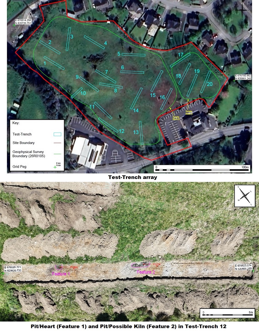
Prior to testing, the site was subjected to a geophysical survey on 5 March 2026, by Shanarc Archaeology Ltd., under survey licence no. 26R0105. The geophysical survey identified numerous potential archaeological anomalies, primarily in the form of possible pit-type features.
Testing comprised the excavation of twenty targeted test-trenches, which primarily focused on those anomalies identified as potential archaeology during the geophysical survey. Two archaeological features were identified in Trench 12, these comprised a small pit/hearth with evidence of in-situ burning (Feature 1), and a larger pit/possible kiln (Feature 2); Feature 1 corresponded to the location of one of the anomalies identified during the geophysical survey. No archaeological finds, features, or deposits were identified in any of the other test-trenches, and aside from the anomaly associated with Feature 1, all other targeted geophysical anomalies were found to be either natural or related to modern agricultural disturbance.