
2026:200 - Rathmullen Cycleway and Oldbridge Boardalk, Meath
County: Meath
Site name: Rathmullen Cycleway and Oldbridge Boardalk
Sites and Monuments Record No.: ME020-039---
Licence number: 24E1115
Author: Niall Roycroft
Author/Organisation Address: c/o Meath County Council, Buvinda House, Dublin Road, Navan, Co Meath. C15 Y291.
Site type: Bridge
Period/Dating: Modern (AD 1750-AD 2000)
ITM: E 705388m, N 775507m
Latitude, Longitude (decimal degrees): 53.718580, -6.403280
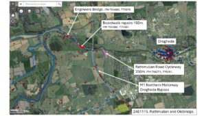
Meath County Council completed repairs on the Oldbridge Boardwalk (ITM 705388, 775507) (150m) and built the Rathmullan Road Cycleway (350m) (ITM 706271, 775261) between October 2024 and February 2025. As an extension of this work some repairs were also monitored on the Boyne Navigation ‘Engineers Bridge’, ITM 704680, 775978.
Oldbridge Boardwalk (built 2014) repairs from being burnt in 2018: 150m
The 2018 emergency repair consisted of chippings dumped and levelled in the River Boyne tidal floodplain. These were removed on 9-10 October 2024. No archaeology was found. The excavated level exposed the tops of the higher remains of the piles burnt in 2018, set in the 2014 piling mat that was required to drive the piles at that time. This mat material was retained for the 2024 works. New piles for the new boardwalk were sunk in the areas of the old ones. The entire impact area was considered to be around 2 sq. m.
Rathmullan Road Cycleway: 350m
The Rathmullan Road ‘valley’ (which is topographically similar to King Williams Glen, Co. Louth) was used as a cavalry route during the Battle of the Boyne, 1690. However, the present road was clearly built in the 18th-19th century and the adjacent stream had been culverted in a buried concrete pipe for the southern 250m in the later 20th century. A short section of large, cobbled roadside gutter from the 18th-19th century road was exposed in one section. The original backfilled roadside ditch (used for several modern services) and the space for the original grassed verge were recorded in numerous locations.
Alongside an original bend in the road towards the middle-northern end was a low parapet wall approx. 30m long x 0.5m high on the roadside, which retained the unburied stream channel up to 2.5m deep. This wall had been damaged by traffic impacts and there was much dumping. The northern 100m of the stream channel was re-cleaned of infill from nearby housing estates and high bedrock was noted. At the River Boyne end, late-20th-century soils had surrounded a 1940’s ruined building with mass concrete walls and corner buttresses, known locally as ‘Rafferty’s Mill’. Effective metal detecting in this entire Rathmullan Road litter-filled environment proved impossible. All soils were retained on site.
Engineers Bridge
Repairs and waterproofing to the arch soffit of the Engineers Bridge found a piece of graffitied mortar attached to the north-west arch springer. The name appears to be ‘T NEVIN 1941’ which was presumably when the bridge was widened. The graffiti was retained in situ. In addition, the adjacent Emergency Era Pillbox on the Engineers Bridge was also surveyed and retained in situ. A further survey recorded the nearby Boyne Navigation water control sluice mechanism (an open, vertical pipe into which water flows when it reaches a certain height) and outflow arrangement.