2025:654 - Campsie Industrial Estate, Upper Campsie and Donnybrewer, Derry, Derry
County: Derry
Site name: Campsie Industrial Estate, Upper Campsie and Donnybrewer, Derry
Sites and Monuments Record No.: N/A
Licence number: AE/2025/111
Author: András Hindli
Author/Organisation Address: c/o JC&A: Burnside, St Oran's Rd, Buncrana, County Donegal
Site type: Pits, possible charcoal production, post-holes
Period/Dating: Prehistoric (12700 BC-AD 400)
ITM: E 650537m, N 921230m
Latitude, Longitude (decimal degrees): 55.036026, -7.209428
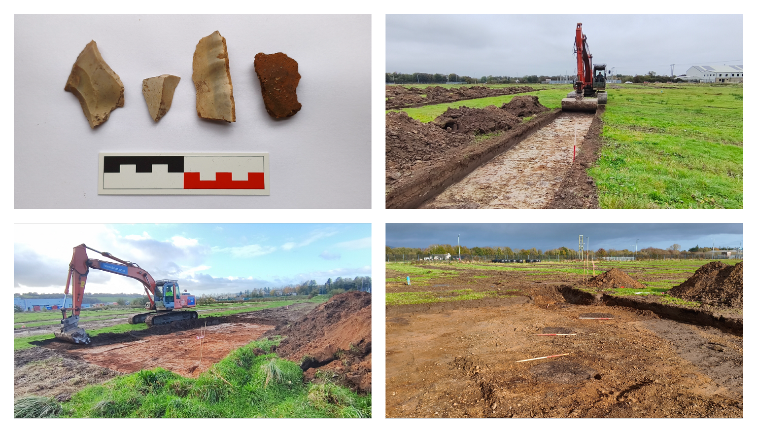
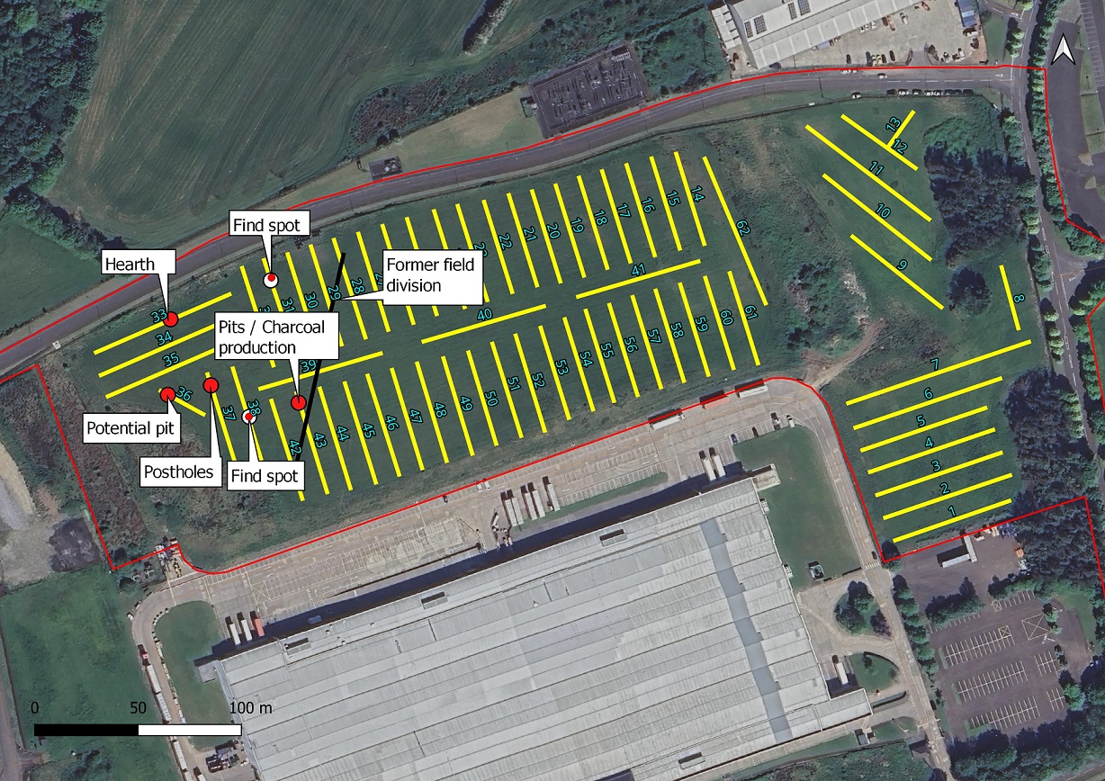
A total of 62 linear test trenches with a combined length of 3180m were excavated for a proposed distribution and storage facility in Upper Campsie and Donnybrewer, Derry. While the majority of trenches yielded no features or deposits of archaeological consequence, a small number of archaeological features and artefacts were revealed confined to the western corner of the larger field, which may represent localised sporadic prehistoric activity (possibly Neolithic) or temporary occupation. Through discussions with HED, it was agreed to topsoil strip a small number of cuttings around some of these features (3 boxes, two of which measured 10m x 10m and one 30m x 20m.) Consequently, more potential archaeological remains were revealed totalling 13 features and 4 artefacts:
Feature 01 (IG co-ordinates: 250451,421232): Consisted of a small oval-shaped hearth that was found towards the middle portion of trench T33. The feature measured 0.4m in length and 0.35m in width and presented remains of scorched in-situ burning and charcoal remains.
Feature 02 (IG co-ordinates: 250450,421196): This feature comprised an oval, pit-like cut measuring approximately 2m in length, 1.75m in width, and at least 0.3m in depth. Its fill contained occasional charcoal inclusions and lenses of redeposited natural subsoil.
Features 03 and 04 (IG co-ordinates: 250471,421201): These two features were identified at the north-western end of trench T37 and represent the remnants of post-holes. Feature 03 was circular in plan and measured 0.34m in diameter. The excavated quadrant revealed relatively straight edges with a depth of 0.25m. Potential stone-packing was noted adjacent to the edge of the cut. The feature was filled by a dark grey silty clay context containing charcoal inclusions. The second similar feature (Feature 04) was located approximately 1.8m southeast of the aforementioned and was assumed to have the same characteristics.
Features 05 and 06 (IG co-ordinates: 250514,421194): Feature 05 comprised of a sub-circular, pit-like cut measuring approximately 1m in length, 0.9m in width, and at least 0.25m in depth. The excavated quadrant revealed three distinct fills within a cut displaying scorched sides, a sharp break between top and base slopes, moderately concave sides, and a flat base. The basal deposit consisted of a concentrated 0.08m–thick layer of large charcoal fragments, overlain by a similar thickness of redeposited natural subsoil. The uppermost fill comprised a relatively sterile mid-brown sandy clay. Approximately 2.2m southwest of Feature 05 was a second feature (Feature 06), exhibiting similar characteristics.
Feature 7 (IG co-ordinates: 250446,421198): This feature comprised a circular, charcoal-rich pit-like feature measuring 0.45m in diameter. A very high concentration of flecks of charcoal was visible on its surface.
Feature 8 (IG co-ordinates: 250469,421201): It is uncertain if this feature consists of the remnants of a stake-hole or a truncated former post-hole, similar to Feature 03. The feature was irregular in plan, measuring 0.17m in length and 0.11m in width. A fragment of prehistoric pottery was recovered from the surface of this feature, which appeared to contain a moderate amount of charcoal inclusions.
Feature 9 (IG co-ordinates: 250469,421200): This feature was identified 1.6m southwest of Feature 03 and both shared similar character in size and composition. The feature comprised of a circular post-hole or pit-like feature, measuring 0.4m in diameter and containing a moderate amount of charcoal inclusions. A hand-dug quadrant revealed a depth of at least 0.2m, possible stone packing and similar fill composition to Feature 03.
Feature 10 (IG co-ordinates: 250471,421199): This feature was located 1.2m southeast of Feature 09 and consisted of an irregular-shaped deposit measuring 0.8m in length and 0.57m in width. The deposit contained frequent charcoal inclusions; however, its archaeological nature remains uncertain. Given the proximity of known archaeological features in the area, it should nonetheless be regarded as potentially significant.
Feature 11 (IG co-ordinates: 250515,421195): This feature was located 1.3m northeast of Feature 05 and was of similar character. The feature was subrectangular in plan, measuring 1.23m in length and 1m in width, containing evidence of scorched/heat-affected edges. Moderate to frequent charcoal inclusions were visible on the surface of its uppermost fill. This feature may represent a charcoal-production pit similar to Feature 05, or alternatively, a structure associated with fire-related activity, such as a kiln.
Feature 12 (IG co-ordinates: 250515,421198): This feature was located 1.8m north of Feature 11 and comprised an oval-shaped pit-like feature with evidence of scorched/heat-affected edges. A hand-dug quadrant revealed that the feature measured 0.98m in length, 0.8m in width and at least 0.25m in depth. In contrast to Feature 05, it lacked a distinct sequence of stratified fills and instead consisted of a single fill with frequent charcoal inclusions.
Feature 13 (IG co-ordinates: 250515,421199): This feature was located almost adjacent to (0.2m distance) and north of Feature 12. It was oval shaped in plan and measured 1.3m in length and 1.1m in width, showing evidence of scorched/heat-affected edges. Given the similarities with the rest of the features revealed within this cutting, the feature was interpreted as a structure associated with fire-related activity, such as a kiln or charcoal-production pit.