2025:516 - Mitchelsfort, Watergrasshill, Cork
County: Cork
Site name: Mitchelsfort, Watergrasshill
Sites and Monuments Record No.: N/A
Licence number: 25E1032
Author: Tony Miller
Author/Organisation Address: Tooreen, Dunmanway, Cork
Site type: No archaeology found
Period/Dating: N/A
ITM: E 575250m, N 582300m
Latitude, Longitude (decimal degrees): 51.992188, -8.360380
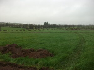
A planning application for a soil recovery site required an impact assessment to include geophysics and test excavation. The site consisted of a large field of improved pasture c.4ha in extent. The land sloped gently down to the west with the M8 along the eastern boundary and the Trantstown River to the west.
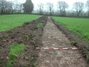
Twelve trenches were excavated running east-west, with a total linear length of c.1740m. They confirmed the findings made in the geophysics report (25R0373). In the northeast of the field was an area with c.0.4m of mid-brown loamy topsoil which overlay orange gravelly boulder clay with plough marks and drains visible. In the northwest of the field variable depths of topsoil overlay disturbed grey gravels showing evidence of subsoiling with a machine to improve drainage. In the southern half of the land minimal depths of a grey, silty topsoil overlay depths of over 1m of introduced materials such as gravels, clays and ballast, all probably originating from the construction phase of the M8. No archaeology was found.