2025:439 - LAG, Cork
County: Cork
Site name: LAG
Sites and Monuments Record No.: CO016-067
Licence number: 25E0482
Author: Enda O Mahony
Author/Organisation Address: Gortageen Millstreet Co Cork
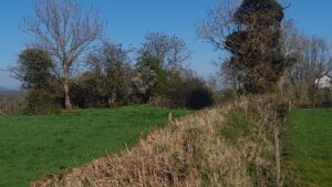
Site type: Ringfort - rath
Period/Dating: Early Medieval (AD 400-AD 1099)
ITM: E 556371m, N 607983m
Latitude, Longitude (decimal degrees): 52.221872, -8.638548
A monitoring licence was required for the proposed construction of a dwelling house, a garage and associated ancillary works in the townland of Lag, Buttevant in Co Cork. The green field site is currently under grass.
The client has applied for planning permission and has received a further information request from the council.
The site was monitored on 23 June 2025 on a dry sunny day with occasional heavy showers. The topsoil was removed using a 1.5m-wide grading bucket.
The topsoil was a dry light brown/red loose silty clay with a low density of stone inclusions. The depth of topsoil varied across the site but was on average c. 0.3m. The interface between the subsoil was very poor and hard to distinguish at times. The subsoil was a loose brown silt with a moderate density of stone inclusions. The landowner informed me that limestone bedrock was very close to the surface and is often only a few “feet under the soil”.
During the course of the works the building contractor was informed of the location of the ringfort and agreed no material will be stored or stockpiled in the exclusion zone between the ringfort and the development.
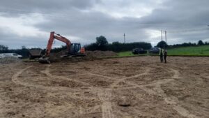
No archaeological features or deposits were noted in the exposed subsoil.