2024:542 - BALLYDUFF WEST, Kilmeaden, Waterford
County: Waterford
Site name: BALLYDUFF WEST, Kilmeaden
Sites and Monuments Record No.: WA016-116001 & WA016-116002
Licence number: 24E0551
Author: Michael Greiner & Seán Shanahan; Shanarc Archaeology Ltd.
Author/Organisation Address: Unit 39a, Hebron Business Park, Hebron Road, Kilkenny
Site type: No archaeology found
Period/Dating: N/A
ITM: E 649906m, N 609164m
Latitude, Longitude (decimal degrees): 52.231954, -7.269416
Archaeological monitoring was carried out on 18 June 2024 at a development site in Ballyduff West, Kilmeaden, Co. Waterford.
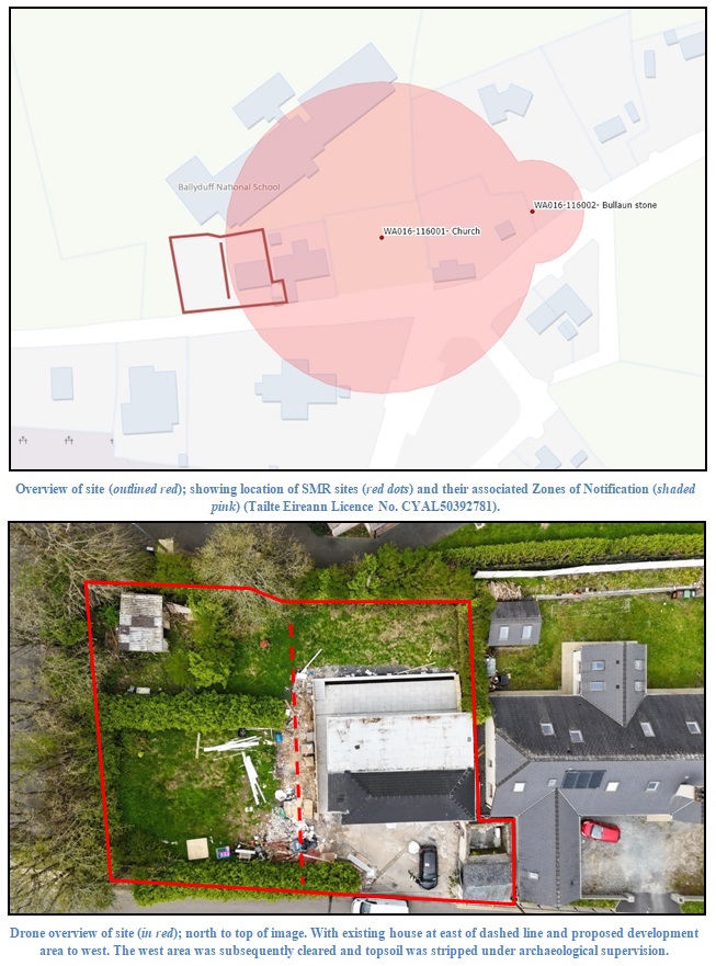
The proposed development comprised the sub-division of an existing c. 0.1-hectare residential site, and the construction of a new residential dwelling in the garden area at western half of the sub-divided site. The eastern half of the sub-divided site contains a dwelling house, and falls within the Zone of Notification (Zone ID: R132388) associated with a recorded church site (WA016-116001-) and a bullaun stone (WA016-116002-).
Monitored works comprised site clearance, sod removal and topsoil stripping across the proposed development area.
The stratigraphy of the excavated materials was consistent across the monitored area of the site, comprising a sod layer c. 0.1m in depth overlying a topsoil layer composed of moderately compact, mid-brown sandy silt, above natural subsoil, described as compact mottled orange-brown to yellow shale deposit mixed with sandy silt. A single modern pit feature was identified at the west of the site.
No archaeological finds, features or deposits were identified during any of the monitored groundworks.