2024:254 - BALLINGARRANE, Tipperary
County: Tipperary
Site name: BALLINGARRANE
Sites and Monuments Record No.: N/A
Licence number: 24E0876
Author: Paul Stevens, Archaeological Management Solutions Ltd
Author/Organisation Address: 19 High Street, Kilkenny
Site type: No archaeology found
Period/Dating: N/A
ITM: E 617704m, N 623053m
Latitude, Longitude (decimal degrees): 52.358770, -7.740088
Archaeological Management Solutions (AMS) was engaged to prepare a Cultural Heritage Impact Assessment (CHIA), including archaeological testing, in advance of a proposed development at Ballingarrane Business, Science and Technology Park, located immediately west of Clonmel town.
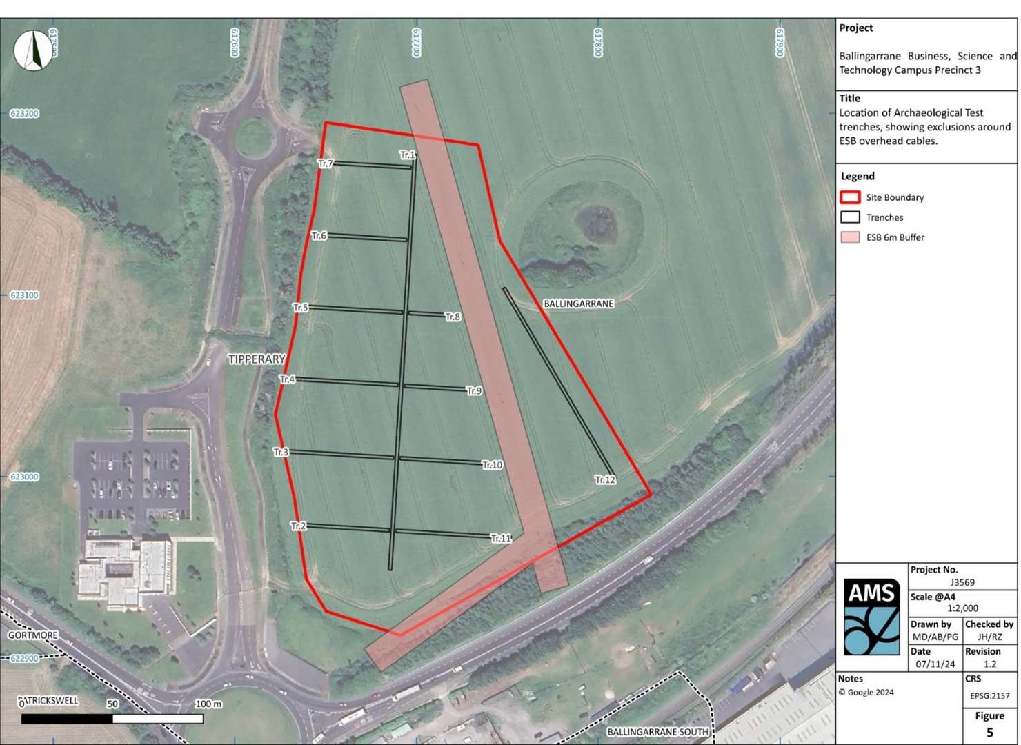
The proposed development at Ballingarrane (Precincts 3) comprises two fields and is located immediately to the north of the N24 National Primary route and to the east of the existing internal access road serving Ballingarrane. The present site (3.65ha) is located in the southernmost part of Precinct 3.
A programme of archaeological test-trenching across 5% of the proposed development site, totalling 845 linear metres, was undertaken. No archaeological finds, features or deposits were encountered during testing; however, there is potential for archaeological material to survive in untested portions of the site within a pond area (AAP-01), as lacustrine areas are archaeologically sensitive, and the site is within a south-facing greenfield hill in proximity to the River Suir. Therefore, licensed archaeological monitoring of all groundworks is recommended during site-preparation works.