2024:275 - KNOCKCONAN, Emyvale, Monaghan
County: Monaghan
Site name: KNOCKCONAN, Emyvale
Sites and Monuments Record No.: N/A
Licence number: 24E0256
Author: András Hindli
Author/Organisation Address: Burnside, St Oran's Rd, Buncrana, County Donegal
Site type: No archaeology found
Period/Dating: N/A
ITM: E 667393m, N 847130m
Latitude, Longitude (decimal degrees): 54.368359, -6.962908
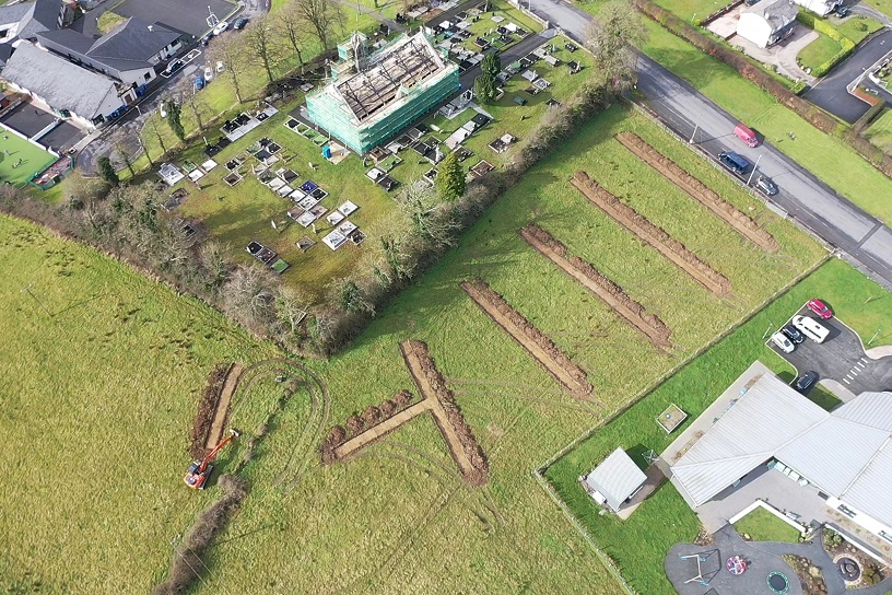
A programme of archaeological testing consisting of the excavation of 7 linear trenches (200m in total) was carried out during the course of one day within lands at Knockconan townland, Emyvale, County Monaghan. The majority of the trenches revealed modern agricultural traces in the form of plough marks and occasional drains. Generally, the topsoil consisted of a mid-brown sandy clay containing occasional small sub-angular stones and modern ceramic inclusions. The topsoil overlaid a transitional layer composed by a mid-brown mixed topsoil and clayed soil, commonly generated as consequence of agricultural deep ploughing. This context also contained occasional inclusions of modern ceramics, and traces of plough marks were visible on its surface. This transitional layer was also excavated in order to reveal the underlying natural geological subsoil. The natural subsoil consisted of a fairly plastic, mottled yellowish and light-brown clay with very occasional small stone inclusions.
No features, or deposits of archaeological consequence were observed within any of the trenches excavated.

