2024:610 - PORTLAOISE: Silt Removal works, Glendowns Pond, Litlle Borris stream, Beladd, Laois
County: Laois
Site name: PORTLAOISE: Silt Removal works, Glendowns Pond, Litlle Borris stream, Beladd
Sites and Monuments Record No.: N/A
Licence number: 24E0377 Ext., 24D0160 Ext., 24R0211 Ext.
Author: Rex Bangerter, ADCO
Author/Organisation Address: No. 2, Main Street, Bennettsbridge, Co. Kilkenny
Site type: Watercourse and Pond
Period/Dating: Modern (AD 1750-AD 2000)
ITM: E 647808m, N 698334m
Latitude, Longitude (decimal degrees): 53.033539, -7.287220
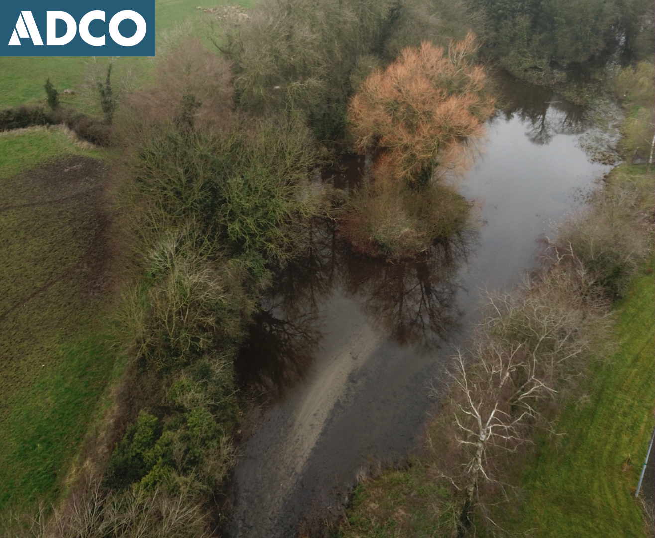
Glendowns Pond has undergone extensive waterborne deposition over the past twenty-years. In order to address on-going siltation and improve the waterbody’s biodiversity value, the pond area was dredged, using a tracked machine excavator, back to its original bed level.
Glendowns Pond is located along the western boundary of Glendowns Housing Estate, on the south-east side of Portlaoise town centre. It is situated in a semi-urban setting, with fields to the southwest, and modern housing to the east. It is fed by the Little Borris stream, a tributary of the Triogue River, a watercourse that follows the line of an aqueduct, as depicted on the OS historic map.
An Underwater Archaeological Impact Assessment (UAIA) was completed by ADCO in March 2024; DHLGH license numbers 24D0160 and 24R0211. The survey extended across the full extent of Glendonws Pond, between ITM 647842E, 698239N (upstream extent) and ITM 647808E, 698455N (downstream extent). No features, deposits, or material of archaeological and/or historical interest were encountered within the proposed impact area at Glendonws Pond, the surface of the pond comprising recently deposited material. Moreover, the pond itself comprised a relatively modern feature, presumably created in the early to mid-twentieth century and most certainly after surveying for the OS 25-inch map was completed in 1909.
Only one feature of interest was encountered, comprising a masonry culvert of nineteenth-century date located c. 35m downstream of the pond area (ITM 647808E, 698458N 9), running beneath the existing N80 roadway:
The silt removal works commenced on 16 September 2024. The resulting dredged material was stockpiled in a series of spoil-heaps, positioned on the east side of the pond. This method allowed comprehensive inspection and intensive metal-detection of all deposits removed from the pond.
Dredge-material comprised a deposit of dark grey sandy-silt (30%/70% mix) of medium plasticity overlying (to a depth of between 400mm and c. 1m) the natural bed-level of the pond. The underlying bed is composed of a light grey/brown silty-sand (40%/60% mix) with frequent grit/gravel inclusions.
The original bed-level of the pond proved to be well-defined, allowing controlled removal of the overlying deposits. The dredge material did not retain any items older than material that was produced in the last 20-30 years.
The silt-removal works were completed on 8 October 2024.