2024:609 - STRADBALLY: Silt Removal Works, Stradbally Bridge, Laois
County: Laois
Site name: STRADBALLY: Silt Removal Works, Stradbally Bridge
Sites and Monuments Record No.: N/A
Licence number: 23E0776, 23R0396, 23E0776 Ext., 23R0396 Ext
Author: Rex Bangerter, ADCO
Author/Organisation Address: No. 2, Main Street, Bennettsbridge, Co. Kilkenny
Site type: Bridge
Period/Dating: Modern (AD 1750-AD 2000)
ITM: E 657173m, N 696344m
Latitude, Longitude (decimal degrees): 53.014738, -7.147963
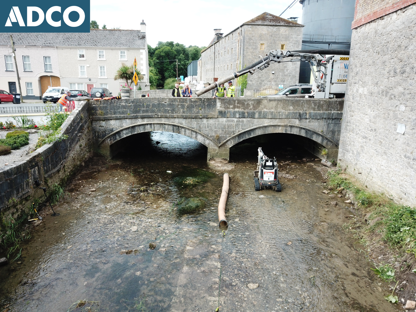
Archaeological Monitoring of silt removal works on the upstream side of Stradbally Bridge was undertaken over a four-day period between 12–15 September 2023 and 1–4 July 2024—elevated water levels having delayed the original completion date.
Stradbally Bridge (NIAH 12900429) comprises a three-ached limestone structure, built c. 1807, that spans the river channel. The structure accommodates the N80, a roadway which runs southeast-northwest through the centre of Stradbally town.
Historic structures, associated with nineteenth-century brewing/milling activity, are located on the north side of the river, both upstream and downstream of Stradbally Bridge, NIAH numbers 12900430 and 12900402 respectively. A number of recorded archaeological sites are also located nearby, situated 70–80m to the north-northeast of the project boundary. These comprise the site of O’Mores Castle (RMP LA014-039001-); a Franciscan Monastery (LA014-039002-), founded in 1447; a Bawn (LA14-039003), associated with O’Mores Castle; and a fortified house (RMP LA014-039004-).
ADCO previously completed (in 2022) an Underwater Archaeological Impact Assessment (UAIA) for the project, recording a number of nineteenth-century in-river/riverside features. None of the identified features were to be directly or indirectly impacted by the silt removal works.
In-river works extended 37.9m from the downstream side of Stradbally Bridge, where (in recent years) a series of vegetated silt and gravel berms had developed. Reed canary-grass was also present, towards the channel centre and along the base of the attendant banks. The gravel/silt berms and associated vegetation were removed using a 1-tonne (tracked machine) micro-excavator, removing material to a point that was level with the existing waterline to reinstate the channel to its previous (pre-deposition) bed-level.
The archaeological monitoring and associated metal-detection did not recover any material of particular interest, encountered items being of late nineteenth-century or later date, comprising pottery fragments (Creamware, Blue & White ware), red-brick pieces, modern coins, etc. However, an archaeological feature was uncovered, mid-channel at ITM 657185E, 696355N (centre-point). It comprised a 3.4m length of wall foundation, orientated east-west, lying flush to the original bed level of the river. The feature was not impacted upon, merely being exposed by the excavation work.
The structure appears to correspond to a cartographic feature that is depicted on the OS 25-inch map of 1909, and is likely associated with an adjacent (nineteenth-century) mill building (NIAH 12900402).
The wall feature has been recorded and is catalogued as Feature 5, following on for the sequence of features previously identified as part of the UAIA.
The archaeological monitoring was conducted under the following DHLGH licences: 23E0776, 23R0396 (2023) and 23E0776 Ext., 23R0396 Ext. (2024).