2024:545 - KILKENNY: No. 23 Black Mill Street, Jamesgreen, Kilkenny
County: Kilkenny
Site name: KILKENNY: No. 23 Black Mill Street, Jamesgreen
Sites and Monuments Record No.: KK019-026
Licence number: 24E0528
Author: Michael Greiner & Graeme Laidlaw; Shanarc Archaeology Ltd.
Author/Organisation Address: Unit 39a, Hebron Business Park, Hebron Road, Kilkenny
Site type: No archaeology found
Period/Dating: N/A
ITM: E 650156m, N 656091m
Latitude, Longitude (decimal degrees): 52.653690, -7.258711
Archaeological monitoring of groundworks associated with a residential development involving the demolition of a single-storey extension and the construction of a new two-storey extension to the rear of an existing dwelling at 23 Black Mill Street, Kilkenny, was carried out between 27 August and 10 September 2024.
The site is located within the archaeological Zone of Notification (Zone ID: R191607) for the historic town of Kilkenny (KK019-026—-).
Following the demolition of the extension (6m in length by 4m in width) at the rear of the dwelling, and the removal of a small section of the northern boundary wall closest to the house, to give access for the mechanical excavator, ground reduction works for the new extension commenced.
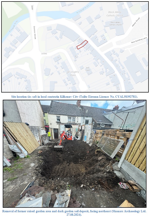
A modern raised garden feature, edged with concrete blocks and modern brick, immediately to the rear of the demolished extension, was removed, along with a small amount of modern refuse. A large quantity of loosely compacted dark brown sandy silt (garden soil) was found for c.5.5m across the former raised garden area. This deposit measured 0.6m in depth and 4m wide, and contained a small amount of small and medium-sized sub-rounded stones. The deposit also contained modern rubbish, including bottles and plastic, along with a small number of broken flagstones. Below this deposit, a moderately compact, mid-grey coarse sandy gravel deposit was exposed. This deposit covered the new extension foundation cut to a depth of 0.3m. A light yellow silty sandy deposit containing small brick fragments was also exposed in places within the new extension foundation area below the garden soil.
The southern boundary wall, formerly enclosing the rear raised garden and yard, comprised corrugated iron sheets on timber posts and bracing; this was also removed, and its removal exposed the partial remains of a possible earlier wall constructed of rubble stone (sub-rounded and angular limestone) that abutted the south wall of the demolished extension.
Excavations to facilitate the installation of a rebar foundation against the upstanding house exposed the modern foundation of the demolished extension (south side) and the limestone footing of the house. Excavations exposed a damaged cement layer above a thick charcoal layer from c. 0.3m below the former floor level of the removed extension, representing surfaces predating the extension. The charcoal layer abutted flagstones to the north side; the charcoal layer and flagstones, modern in date, were left in situ.
The final stages of monitored groundworks involved the removal of a concrete surface and boundary wall located outside the rear doorway of the house.
No finds, features or deposits of archaeological significance were identified during any of the monitored excavations.