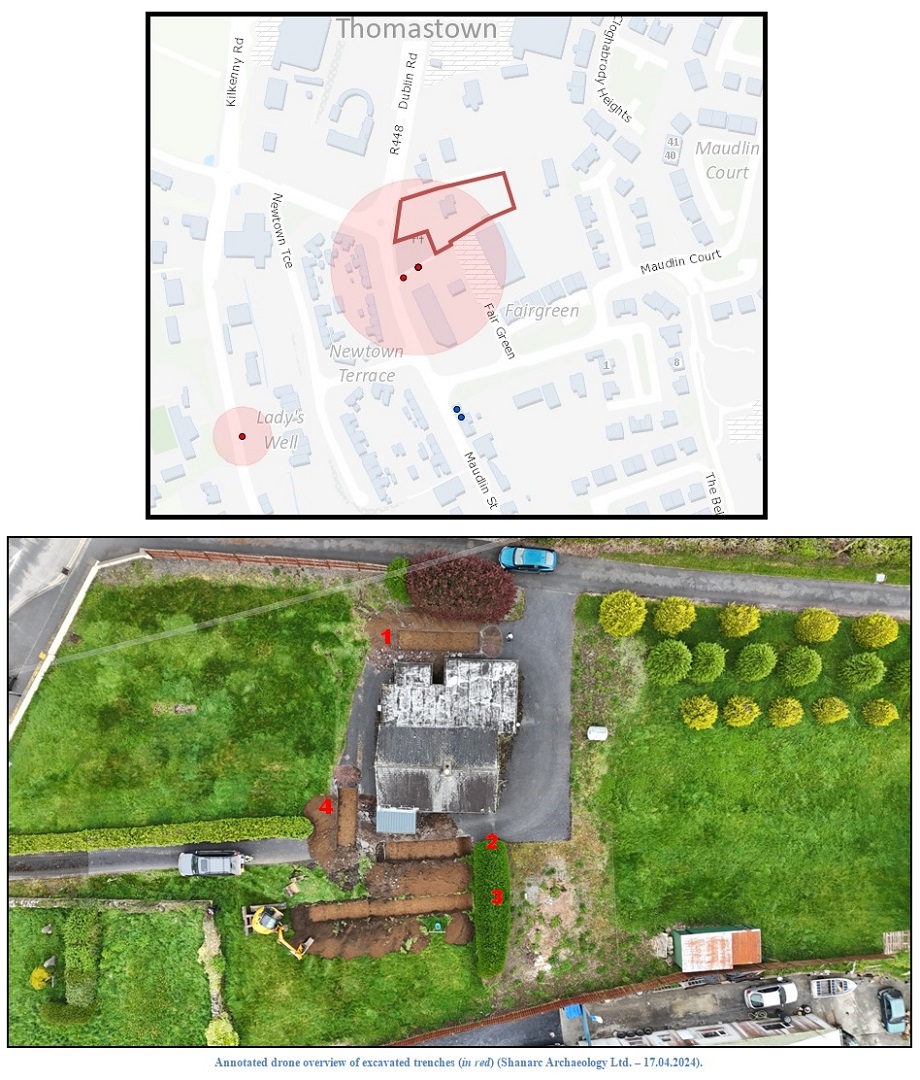
2024:077 - CLOGHABRODY, Thomastown, Kilkenny
County: Kilkenny
Site name: CLOGHABRODY, Thomastown
Sites and Monuments Record No.: KK028-038001-, KK028-038002-, KK028-038003-, KK028-038004-, KK028-038005-,
Licence number: 24E0456
Author: Michael Greiner & Seán Shanahan; Shanarc Archaeology Ltd.
Author/Organisation Address: Unit 39a, Hebron Business Park, Hebron Road, Kilkenny
Site type: No archaeology found
Period/Dating: N/A
ITM: E 658362m, N 642380m
Latitude, Longitude (decimal degrees): 52.529648, -7.139859
Archaeological test-excavations were carried out as part of an Archaeological Impact Assessment Report, in relation to a proposed redevelopment of an existing dwelling at Cloghabrody, Thomastown, Co. Kilkenny.
The development site lies within the Zone of Notification (Zone ID: R138669) associated with a complex of recorded archaeological monuments, consisting of the Magdalene church site (KK028-038001-), graveyard (KK028-038002-), enclosure (KK028-038003) and hospital (KK028-038004), as well as an architectural fragment (KK028-038005), in Cloghabrody townland, sited to the east side of the R448 at the junction of Dublin Road, Maudlin Street and Lady’s Well Street/Kilkenny Road (R700), Thomastown.
Test excavation comprised the excavation of four test-trenches to the north, south and southwest of the existing dwelling, within the proposed development footprint.
The excavated trenches measured 5–13m in length, 2m in width, and 0.38–0.55m in depth. A small pit containing modern pottery and two fragments of clay pipe were identified in Trench 1; aside from this no other archaeological finds, features or deposits were identified in any of the excavated trenches.

