2024:480 - CLOGHERCLEMIN, Tralee, Kerry
County: Kerry
Site name: CLOGHERCLEMIN, Tralee
Sites and Monuments Record No.: N/A
Licence number: 24E0529
Author: Tony Miller
Author/Organisation Address: Tooreen, Dunmanway
Site type: Fulacht fia
Period/Dating: Bronze Age (2200 BC-801 BC)
ITM: E 489079m, N 614549m
Latitude, Longitude (decimal degrees): 52.271432, -9.625281
Pre-planning test excavation was carried out for an extension to an existing soil recovery site. Testing was in two areas: Area C, to the north, and Area D to the east of the existing site. Both areas consisted of level fields of unimproved pasture, created after the cutting of a large area of bog land.
Area C: 6 trenches were excavated east-west beginning at the southern end. A general stratigraphy of c.0.3m of a grey silty topsoil overlay grey marls and gravels with indications of ploughing and drainage works. In the middle of Trench 4 a fulacht fiadh was uncovered at 488927 614578. It consisted of fire-cracked stones and charcoal-rich soils extending c.15m north-south by c.11.5m. There was no surface indication of this monument indicating it had been levelled by agricultural activity.
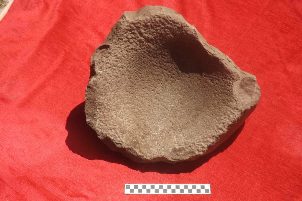
Area D was situated to the east and south of Area C and separated by a tree-lined boundary and drain. Six trenches were excavated east-west beginning to the south. A general stratigraphy was of deep peaty soils overlying grey marl with evidence for ploughing and drainage works. An area near the western end of Trench 2 had a deeper pocket of peat c.0.8m deep. A saddle quern was found at the base of this area at 489074 614408. It measured 0.36m by 0.38m and 0.2m thick, with a concave upper surface 0.1m deep. It appeared to be a stray find within a bog landscape.
Both finds could be considered Late Bronze Age and could have some relevance to the Chute Hall hoard of six trumpets, dated to c.600 BC, found within the townland.