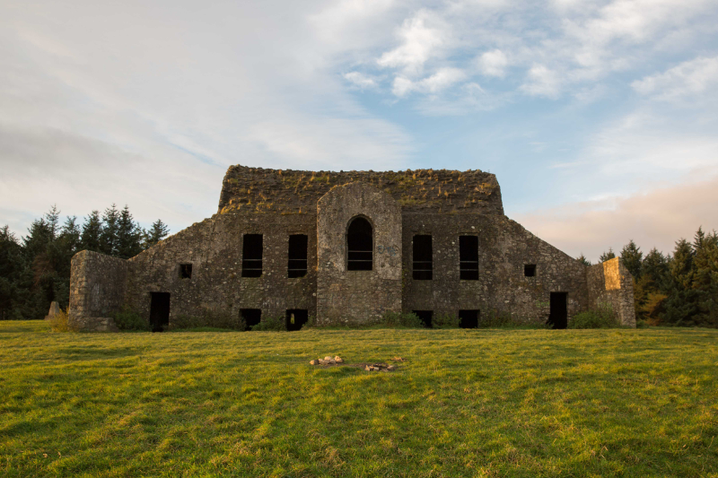
2024:572 - HELLFIRE CLUB, MONTPELIER HILL, Dublin
County: Dublin
Site name: HELLFIRE CLUB, MONTPELIER HILL
Sites and Monuments Record No.: DU025-001003
Licence number: 24E0822
Author: Neil Jackman, Abarta Heritage
Author/Organisation Address: 11 Peter Street, Clonmel, Tipperary
Site type: House - 18th/19th century
Period/Dating: Post Medieval (AD 1600-AD 1750)
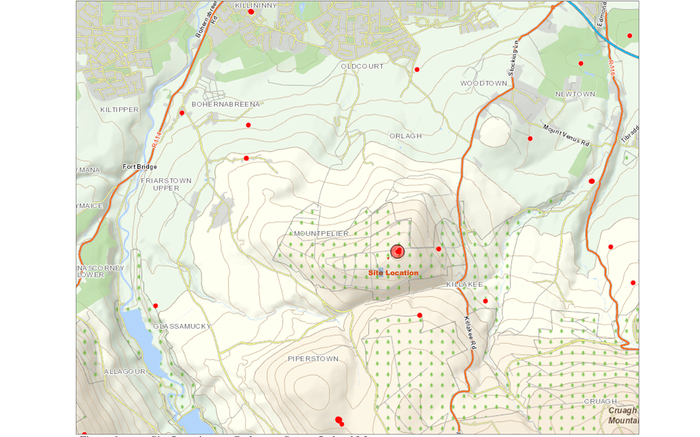
ITM: E 711434m, N 723692m
Latitude, Longitude (decimal degrees): 53.251878, -6.330106
The aim of this test-excavation was to investigate the floor deposits within the interior of the 18th-century hunting lodge, popularly known as ‘The Hellfire Club’ (constructed c.1725). The project was led by Neil Jackman of Abarta Heritage, on behalf of South Dublin County Council in conjunction with Archaeology and Built Heritage LTD, 7L Architects and Coillte.
This work was designed to assess the nature of the deposits, and to establish the survival, preservation, or otherwise, of any floor surfaces. It was carried out to inform the Conservation Management Plan for the structure, by providing insights and recommendations for the treatment of floor deposits and the exposure of any surviving original floors within the building.
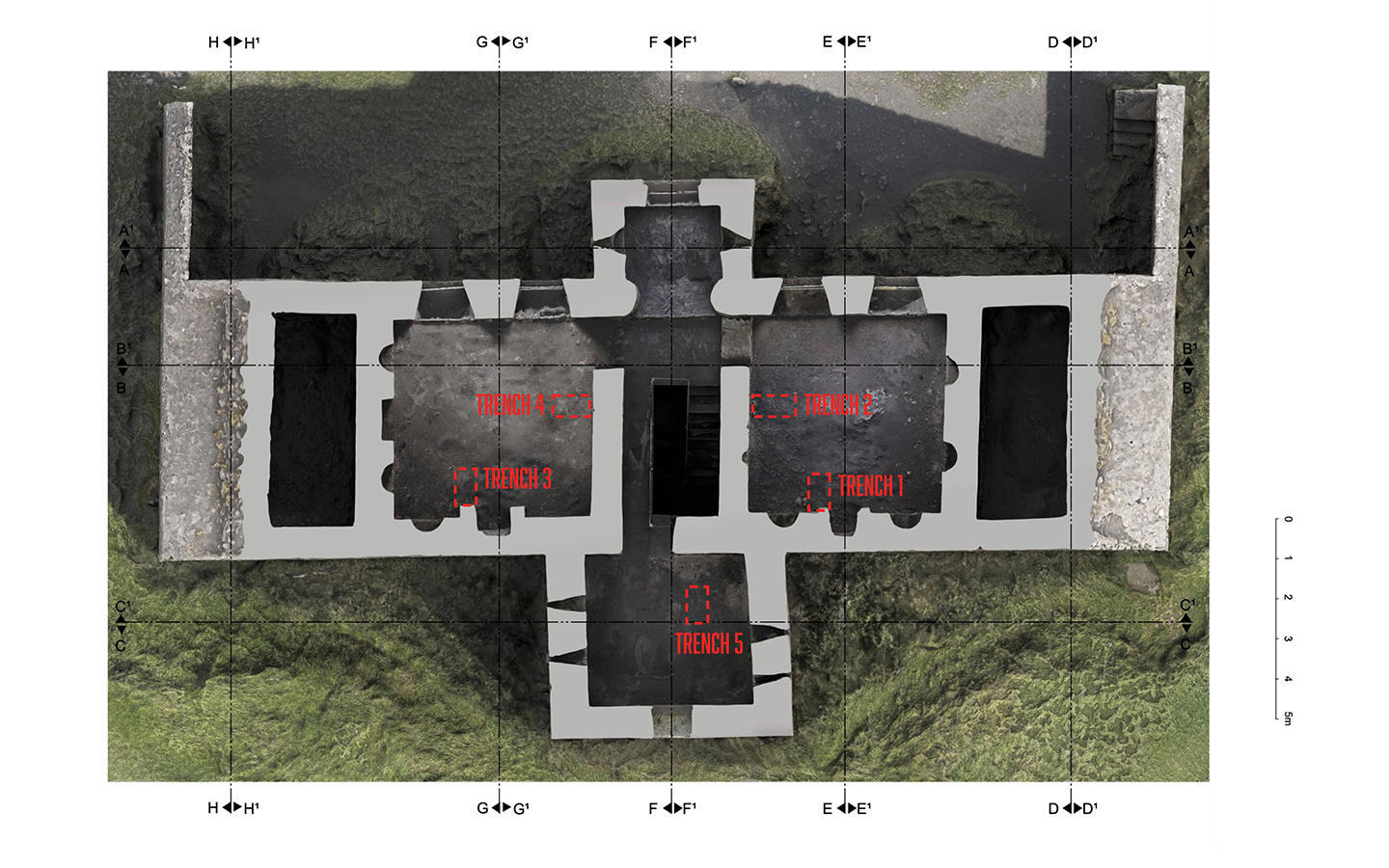
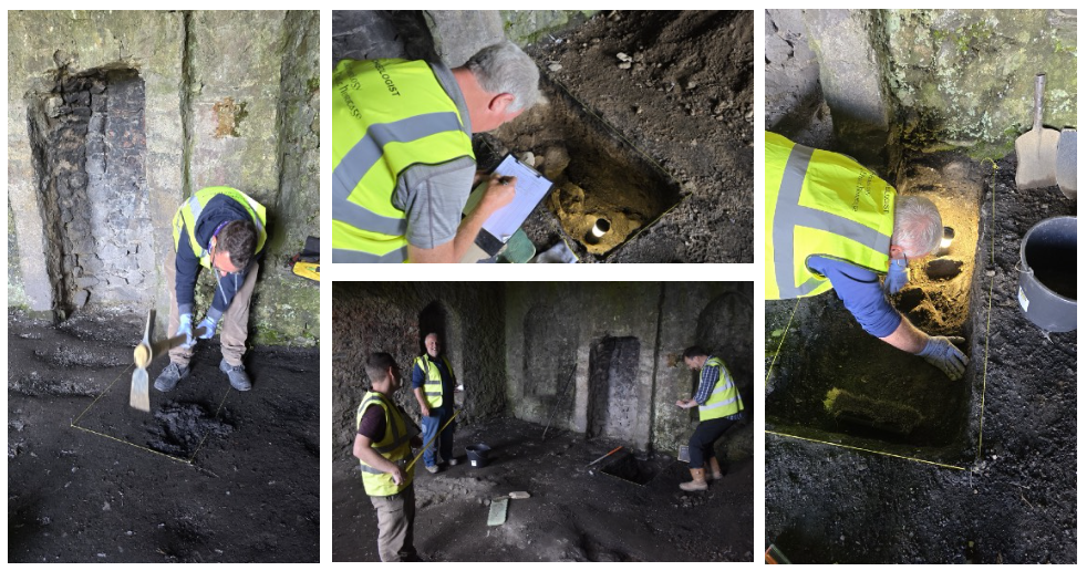
A series of 10 test-trenches, each measuring roughly 1m x 0.5m, were placed in the interior of the 18th-century hunting lodge (see annotated images below). The trenches revealed that the building was essentially constructed as a series of barrel vaults.
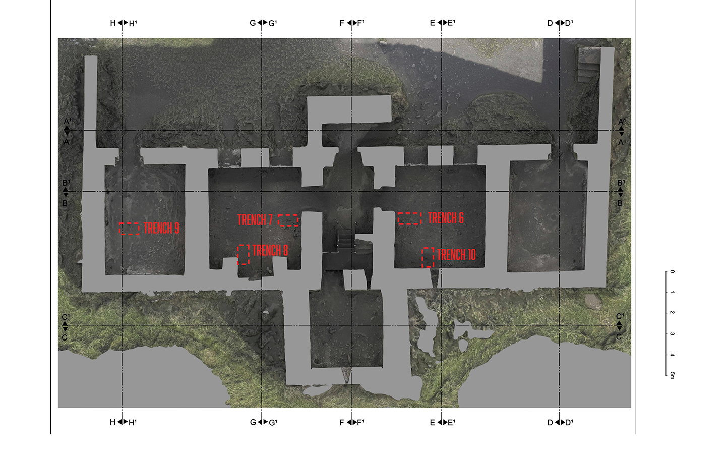
The upper floor was formed by infilling the vault with earth to create a level surface, and then with the application of a thin layer of fairly compact, mortar-like material to act as screed. It is presumed that floorboards, stone flags or tiles were then placed atop the level screed, though no such floorboards or flags were found to survive. The floors of the lower storey of the building were similarly constructed, with a thin screed layer applied to a broadly level layer of earth.
The trenches additionally revealed the level of disturbance inside the building. Thick layers of black burnt material testified to the number of fires endured by the interior, and a significant amount of detritus and plastic was found throughout the uppermost contexts. Following excavation, all trenches were carefully backfilled.
As well as providing insights for the conservation strategy, the results of this test-excavation also contribute towards the ongoing Hellfire Club Archaeological Research Project, that seeks to better understand the archaeological landscape of Montpelier Hill, and the Dublin Mountains. This project will help to further develop the story of the structure known as the Hellfire Club, its construction, use, abandonment and subsequent post-dereliction history.