2024:526 - MOORETOWN (Ellipse Site 2B), Dublin
County: Dublin
Site name: MOORETOWN (Ellipse Site 2B)
Sites and Monuments Record No.: N/A
Licence number: 23E0311ext
Author: Catriona Baldwin
Author/Organisation Address: Lynwood House, Ballinteer Road, Dublin 16
Site type: Settlement cluster
Period/Dating: Multi-period
ITM: E 709454m, N 742636m
Latitude, Longitude (decimal degrees): 53.422469, -6.353219
Excavations at Sites 2B were carried out from February to April 2024 and followed on from geophysical survey and testing carried out in 2022. Site 2 was split into Sites 2A and 2B to facilitate the client’s programme, Site 2A is summarised in a separate bulletin report (see 2023:569, McLoughlin).
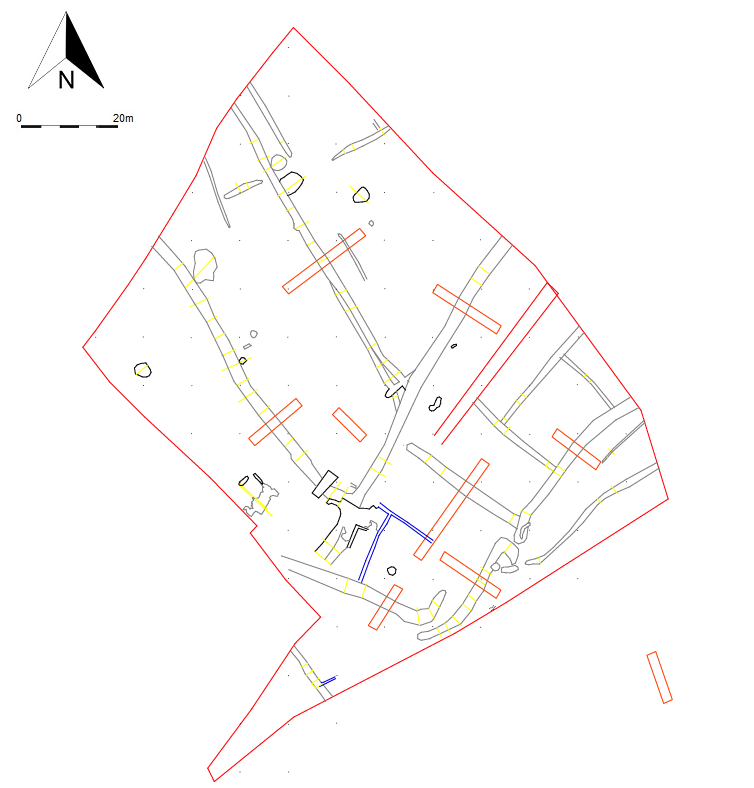
Site 2B comprised the northern half of the overall Site 2. The area was initially indicated on geophysical survey, and testing confirmed the features were archaeological in nature. Excavation revealed an extensive area of ditches, pits and burnt spreads associated with later medieval and post-medieval pottery. For the most part, the medieval activity was confined to the southern and south-western extent of the site and consisted of the remains of a stone structure, a series of linear ditches, pits and a well. No medieval features appeared to have carried through from Site 2A nor did any of the features from 2B extend into Site 2A. It is clear that these remains were peripheral to the main concentration of medieval settlement on Site 2A and were heavily disturbed by later activity.
The evidence for post-medieval activity on Site 2B predominately comprised north-west/south-east aligned linear ditches and intermittent north-east/south-west aligned ditches. These features relate to boundary divisions and drainage. Other features included an area of metalling associated with several lengths of foundation walls suggestive of a yard area and outbuilding.
A large quantity of post-medieval pottery, along with a large assemblage of metal objects and clay pipes as well as moderate quantities of glass and animal bone were recovered from the site.