2024:268 - LISSENHALL LITTLE, Dublin
County: Dublin
Site name: LISSENHALL LITTLE
Sites and Monuments Record No.: N/A
Licence number: 24E0805
Author: Gill McLoughlin, c/o Courtney Deery Heritage Consultancy
Author/Organisation Address: Lynwood House, Ballinteer Road, Dublin 16
Site type: Settlement cluster
Period/Dating: Late Medieval (AD 1100-AD 1599)
ITM: E 718958m, N 749185m
Latitude, Longitude (decimal degrees): 53.479238, -6.207826
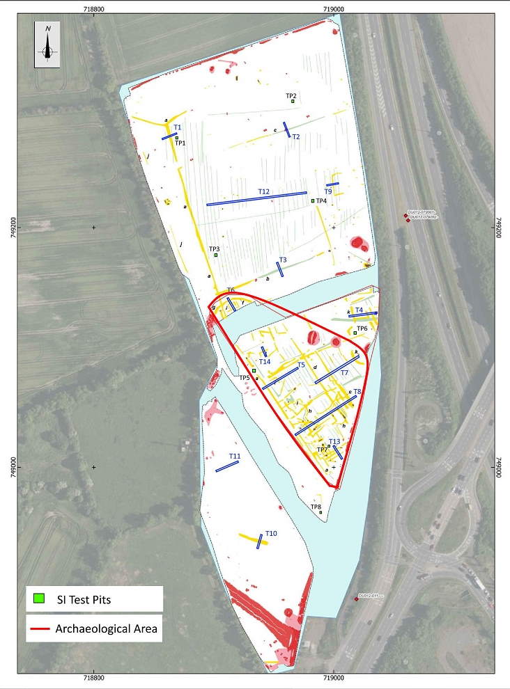
Pre-planning archaeological testing was carried out in a greenfield location at Lissenhall Little, north of Swords, Co. Dublin, adjacent to the west side of Junction 4 on the M1 motorway.
The archaeological testing followed a geophysical survey of the area and took place over five days from 12 August 2024. Archaeological remains were identified in trenches T5, T6, T7, T8, T13 and T14 and for the most part comprised linear ditches and gullies, but also included pits, spreads and a possible stone surface or remnants of a stone structure in Trench T8 where there was a concentration of complex archaeological remains.
In general the features uncovered in the trenches corresponded quite well with the geophysical survey of the area, although additional features were present in some areas, such as in T6.
Testing confirmed a medieval date for the site, with frequent finds of 12th–14th-century pottery present in the fills of tested features and a plough pebble recovered from topsoil is evidence of 13th-century agricultural practices at the site. The pottery has been identified as mostly Dublin-type ware and Leinster Cooking ware.
Monitoring of eight Site Investigation Test Pits was also carried out over two days from 21 October 2024 under an extension of the original licence and archaeological deposits were present in two of the pits (TP05 & TP07). The remains were left undisturbed and the two test pits were relocated to nearby locations and no archaeological remains were found in the relocated test pits.

