2024:409 - RATHFRILAND: 53 Downpatrick Street, Down
County: Down
Site name: RATHFRILAND: 53 Downpatrick Street
Sites and Monuments Record No.: DOW041:092
Licence number: AE/2024/162
Author: Eoin Halpin, AHC Ltd.
Author/Organisation Address: 36 Ballywillwill Road, Castlewellan, Co. Down BT31 9LF
Site type: Excavation - miscellaneous
Period/Dating: Modern (AD 1750-AD 2000)
ITM: E 720004m, N 833536m
Latitude, Longitude (decimal degrees): 54.236607, -6.159111
The development, located on the south side of the town of Rathfriland, Co. Down, on the west side of Downpatrick Street, consisted of the demolition of the existing building at 53 Downpatrick Street (Building at Risk HB 16/08/005) to facilitate the erection of 4 apartments, 5 dwellings and associated site works.
HED (Historic Buildings) considered the effects of the proposal on the listed building and was content the proposal satisfied the policy requirements of SPPS 6.12 and BH11 PPS6, subject to conditions. HED (Historic Monuments) considered the impacts of the proposal and was content that the proposal satisfied PPS 6 policy requirements, subject to conditions for the agreement and implementation of a developer-funded programme of archaeological works.
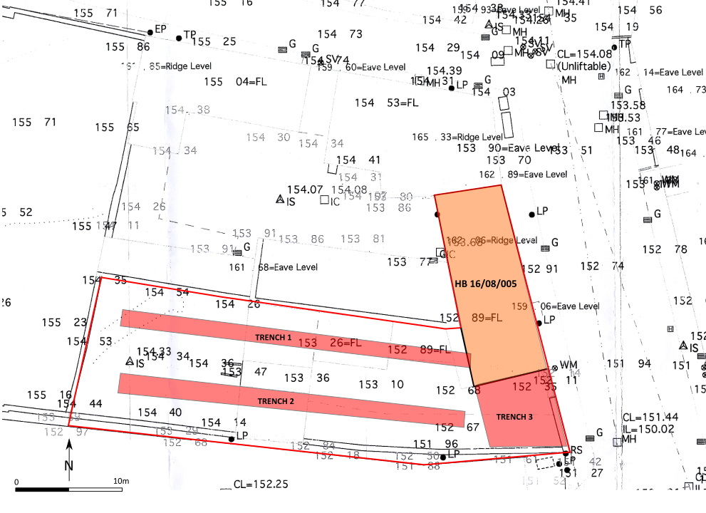
A programme of archaeological testing was proposed, with the work taking place in October 2024. Two test trenches were opened up across the body of the site, with a further area opened up to the south of the building which originally fronted out onto Downpatrick Street.
All of the wall foundations noted within Trenches 1 and 2 corresponded with the projected lines of the buildings recorded on the Ordnance Survey maps of the early 20th century. There was no indication of any earlier surviving buildings or deposits uncovered in either of the trenches. A rectangular pit, accessed by a concrete and steel man hole, uncovered in Trench 1, was also a late feature, as evidenced by the steel joists holding up the roof covering the pit and the fact that a number of iron drainage pipes fed into it. It is probable that this feature was a soakaway and that the stone-filled gully noted in Trench 2 and running along the southern end of area 3, represents a drainage channel running down slope to the southeast, away from the subject site.
There was no evidence in Trench 3 of any buildings extending south from the gable end of the building which stood on the site prior to demolition. It appeared that later disturbance, in the form of a large stone-filled drainage gully, possibly associated with the soakaway uncovered in Trench 1, removed any evidence for any earlier buildings in this area.
Due to the fact that the only features/deposits uncovered dated to the first half of the 20th century or later, it is recommended that, no further archaeological involvement is required for this project.