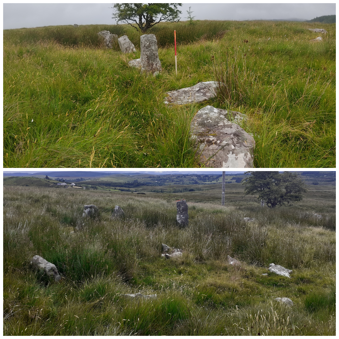
2024:302 - BINBANE TO CATHALEEN'S FALL CIRCUIT UPGRADE, various townlands, Ballyshannon, Donegal
County: Donegal
Site name: BINBANE TO CATHALEEN'S FALL CIRCUIT UPGRADE, various townlands, Ballyshannon
Sites and Monuments Record No.: DG084-002001; DG084-002002
Licence number: 23E0674
Author: András Hindli
Author/Organisation Address: Burnside, St Oran's Rd, Buncrana, County Donegal
Site type: Excavation - miscellaneous
Period/Dating: Undetermined
ITM: E 595552m, N 878567m
Latitude, Longitude (decimal degrees): 54.655261, -8.068929
Archaeological monitoring was undertaken during groundworks for the replacement of existing pole sets and towers associated with the Binbane to Cathalleen’s Fall circuit refurbishment scheme. The Binbane to Cathaleen’s Fall 110kV traverses Donegal countryside for c.34.3km from the Binabane 110kV substation located c.11.5km northeast of Donegal Town, to Cathaleen’s Fall 110kV substation located within the town of Ballyshannon.
A number of archaeologically sensitive areas required Section 12 notifications and a site-specific approach was proposed and reviewed by the National Monuments Service. One of the existing poles to be replaced was known to be located in the vicinity of Burial Ground (DG084-002002) and Stone Circle (DG084-002001). A site inspection in advance of site works revealed that the location mapping of the archaeological sites was not completely accurate and the existing poleset was adjacent to what was recorded as Burial ground (DG084-002002). The recorded stone circle (DG084-002001), still intact though with some fallen slabs, was situated about 30m northwest of the poles and burial ground, following an alignment of various standing stones and boulders. An additional, unrecorded, potential prehistoric standing stone was found approximately 30m north of the recorded stone circle. It was ultimately decided not to replace the previously mentioned poles but to relocate them away from the recorded monument. The previously existing poles were cut down to ground level and removed from the site to prevent further ground disturbance.
The revised coordinates for the archaeological sites are as follows:
-Stone Circle (DG084-002001): E 585006, N 884604 (ITM)
-Burial ground (DG084-002002): E 585026, N 884583 (ITM)
-Potential unrecorded standing stone: E 585002, N 884639 (ITM)
Overall, the monitoring was mostly undertaken at previously disturbed areas, and the presence of previous ground disturbance was evident at each pole set replacement. No additional archaeological features or deposits were identified during this monitoring programme.

