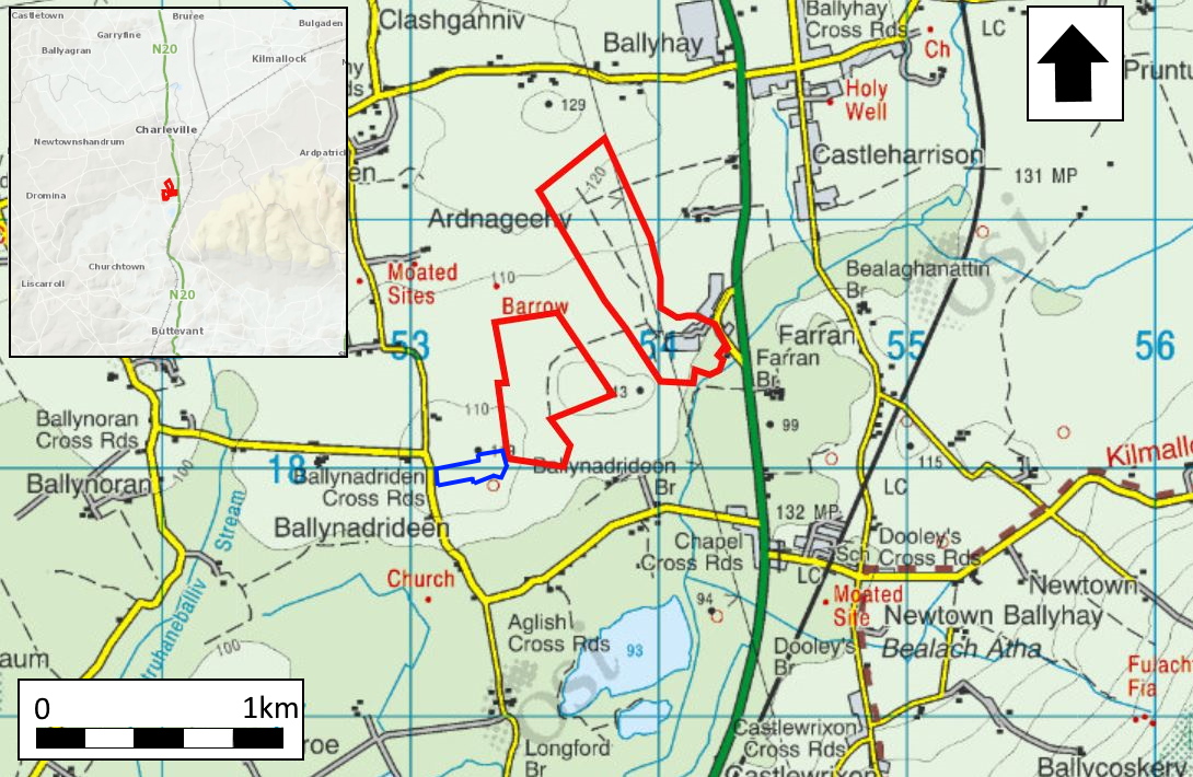
2024:459 - ARDNAGEEHY & BALLYNADRIDEEN, Cork
County: Cork
Site name: ARDNAGEEHY & BALLYNADRIDEEN
Sites and Monuments Record No.: N/A
Licence number: 24E0758
Author: Gill McLoughlin, c/o Courtney Deery Heritage Consultancy
Author/Organisation Address: Lynwood House, Ballinteer Road, Dublin 16
Site type: Ring-ditch and Kiln
Period/Dating: Prehistoric (12700 BC-AD 400)
ITM: E 553790m, N 618830m
Latitude, Longitude (decimal degrees): 52.319153, -8.677806
Pre-planning archaeological testing was carried out at a site under consideration for a proposed solar farm development, c. 3.5km south of the town of Charleville, Co. Cork and just west of the N20 roadway.
Testing targeted possible sites indicated in a geophysical survey and took place over eight days from 21 August 2024 and three days from 2 December 2024. Eight sites were confirmed as being archaeological in nature as a result of the testing (Sites 1, 2, 4, 6, 8, 9, 10 & 11), however it appears that Sites 9–11 along with Site 12 which was not tested, from part of one complex of multiphase activity.
Site 2 is a ring-ditch approximately 11m in diameter with evidence for associated cremation burials in the interior.
Sites 1 and 4 represent possible ditch-type enclosures which produced no dateable finds or environmental material but did correspond with the geophysical survey interpretations and cannot be discounted as being archaeological, although they could also be geological in origin.
Site 6 appears to represent a small enclosure site, approximately 12m in diameter, defined by a shallow ditch/gully containing charcoal.
Site 8 appears to represent a ditched enclosure, likely to be early medieval in date, or a slightly later moated site, although no dateable finds were recovered during testing.
Site 9 comprises several features, one of which may represent part of a ring-ditch, but a second ditch-type feature, a cereal-drying kiln and a large irregular pit were also identified in the trench and the features all have different characters suggesting the possibility of multiphase activity.
Site 10 comprises a probable ring-ditch measuring approximately 14.5m in diameter, a probable kiln and burnt mound activity. It is unclear whether these features are all associated and it is possible that they represent activity from different periods.
Site 11 appears to comprise a ring-ditch measuring approximately 12.5m in diameter along with numerous associated features. The ditches representing the enclosing elements correspond closely with the geophysical anomalies. Associated features, mostly within the interior, comprise pits, possible post-holes and spreads and most of the features contained charcoal and heat-shattered stones suggesting either that the site is related to burnt mound activity or that there is multiphase activity at the site.
Site 12, which lies within the constraint area for a ringfort and souterrain immediately to the south (RMP CO007-054 001 &002), was not tested but appears to be part of the complex of activity which includes Sites 9–11 and the areas between these sites.