2024:440 - KILGOBNET, Clondrohid, Cork
County: Cork
Site name: KILGOBNET, Clondrohid
Sites and Monuments Record No.: N/A
Licence number: 23E0846 ext.
Author: Tony Miller
Author/Organisation Address: Tooreen, Dunmanway, Cork
Site type: No archaeology found
Period/Dating: N/A
ITM: E 527150m, N 576934m
Latitude, Longitude (decimal degrees): 51.939737, -9.059530
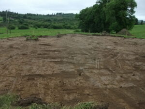
Planning permission for the building of a single dwelling house at this site was granted following a previous geophysics survey (23R0358) and test excavation (23E0846). Monitoring was made a condition of planning and was carried out under the reactivated, previously-held licence.
The required buffer zone was put in place around a bullaun stone (CO059-065004), part of a larger early ecclesiastical site associated with St Gobnait. Monitoring started with clearing and widening the eastern side of an existing entrance onto the public road, which involved removing an earth and stone field boundary. Monitoring then continued with the removal of the topsoil covering the entire development footprint. The site was within a field of improved pasture overlooking the Finnow River to the south. A general stratigraphy was recorded of between 0.1m and 0.3m of a mid-brown loamy topsoil overlying an orange, stony boulder clay. No archaeology was found.