2024:559 - CARLOW: Boake’s Field, Chapelstown, Carlow
County: Carlow
Site name: CARLOW: Boake’s Field, Chapelstown
Sites and Monuments Record No.: N/A
Licence number: 24E1189
Author: Zbigniew Malek, Archaeological Management Solutions
Author/Organisation Address: 19 High Street, Kilkenny, R95 F2KD
Site type: Enclosure/Ring-ditch and Enclosure
Period/Dating: Undetermined
ITM: E 674325m, N 676325m
Latitude, Longitude (decimal degrees): 52.832744, -6.896979
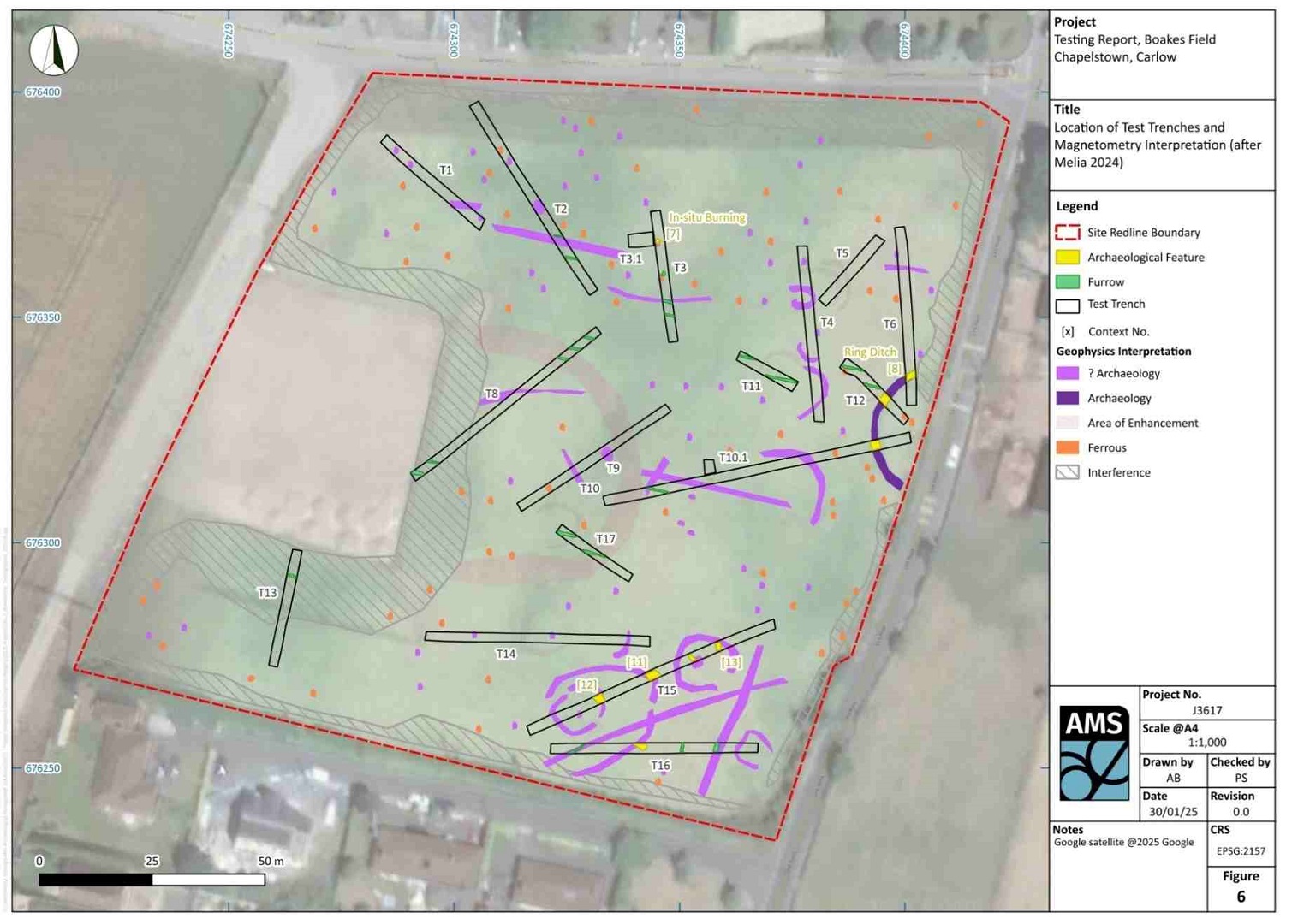
Archaeological Management Solutions (AMS) was engaged to undertake geophysical survey works and archaeological test excavation to accompany a planning application for a proposed residential development. The geophysical survey was also carried out by AMS in 2024 (Melia 2024).
Geophysical survey revealed a number of linear and curvilinear anomalies, interpreted as potential archaeological features (ditches and pits) in addition to sub-circular ferrous responses associated with the presence of surface/subsurface iron (ibid.) In order to identify any subsurface archaeological objects, features or deposits that may have potentially existed on the site, a targeted programme of test trenching comprising sixteen trenches, and two small exploratory trenches was undertaken.
Archaeological testing revealed the remains of a sub-circular ring ditch exposed in three trenches situated at the easternmost edge of the development site. This feature was also noted in aerial survey as a prominent crop mark and is truncated by the Chapelstown Link Road, which also forms the eastern boundary of the site (see Google Map Data ©2025). A second area of possible archaeological potential was also revealed, comprising denuded remains of a several sub-circular/oval enclosures within two trenches, situated in the south-east corner of the site. In addition, an isolated area of potential archaeology comprised an area of in-situ burning within one trench in the centre of the site. Furthermore, a series of cultivation furrows were also revealed across the site, which confirmed the occurrence of organised tillage within this location. Finally, a number of natural glacial variations were noted in testing that coincided with geophysical anomalies that presented as circular trends.