2024:013 - CRUMLIN: Lands southwest of 58 Long Rig Road, Kilcross, Nutts Corner, Antrim
County: Antrim
Site name: CRUMLIN: Lands southwest of 58 Long Rig Road, Kilcross, Nutts Corner
Sites and Monuments Record No.: N/A
Licence number: AE/23/146
Author: Ciara MacManus, Farrimon Macmanus ltd
Author/Organisation Address: Adelaide House, Belfast
Site type: No archaeology found
Period/Dating: N/A
ITM: E 722137m, N 879563m
Latitude, Longitude (decimal degrees): 54.649445, -6.107433
Pre-development archaeological test trenching was carried out at the site of a proposed single dwelling at Long Rig Road, Crumlin, Co Antrim in response to a condition of planning approval.
A desktop study confirmed that the proposed development was situated within an established archaeological landscape with five Scheduled Monuments located within the study area. Three SMR sites, of which two are Scheduled Monuments, are located within 130m of the south site boundary (a Standing Stone – ANT055:273 and a Barrow – ANT055:054). A Standing Stone (ANT055:274) was located 35m from the south-east corner of the proposed development area. The remains of a rectangular building are located along the north site boundary which appears to date to the early 19th century.
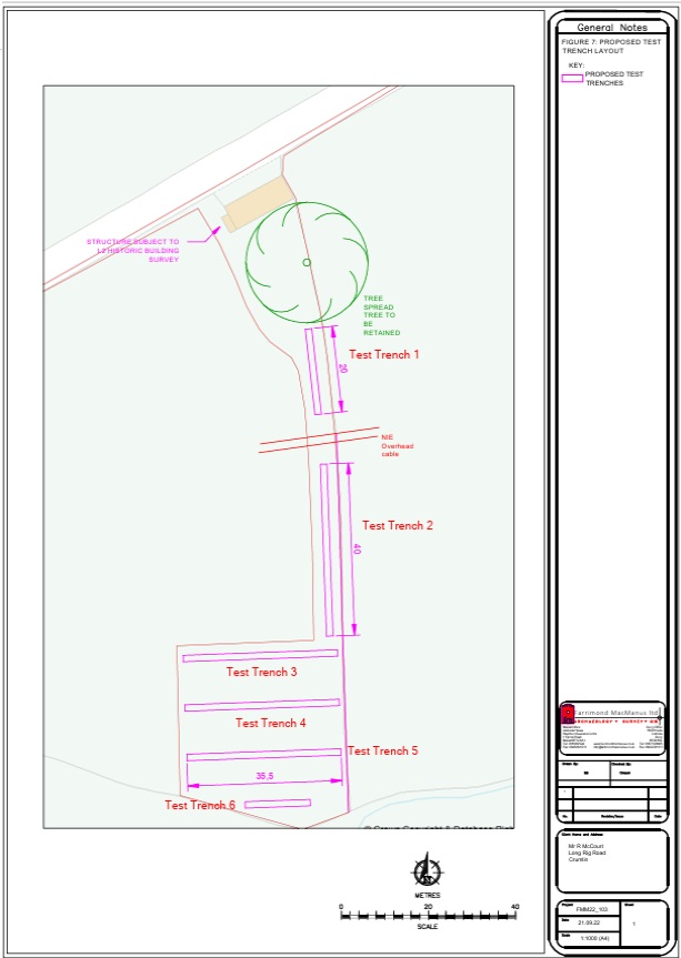
An total of 6 machine-cut test trenches were excavated across the site as a means of identifying whether any subsurface archaeological remains survive which may be impacted upon by the proposed development. This was augmented with a Level 2 Historic Building survey carried out on the existing vernacular building which is proposed for demolition as part of development plans.

