2023:556 - DUNMORE EAST: Killea Road, Killea, Waterford
County: Waterford
Site name: DUNMORE EAST: Killea Road, Killea
Sites and Monuments Record No.: WA027-023001 & WA027-023002
Licence number: 22E0791
Author: Michael Greiner & Seán Shanahan; Shanarc Archaeology Ltd.
Author/Organisation Address: Unit 39a, Hebron Business Park, Hebron Road, Kilkenny
Site type: No archaeology found
Period/Dating: N/A
ITM: E 668256m, N 601844m
Latitude, Longitude (decimal degrees): 52.164199, -7.002299
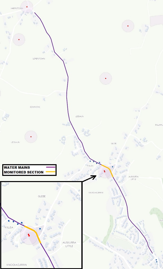
Archaeological monitoring of groundworks associated with the replacement of existing 100mm AC water mains with new mains and associated assets along Killea Road, Dunmore East, Co. Waterford was carried out by Shanarc Archaeology Ltd. for ShareRidge Utilities Ltd. on behalf of Irish Water.
Water mains were replaced along a c. 2.5km stretch of the Killea Road between Fairybush Cross at the north and Marian Terrace, Dunmore East, at the south. Where the water mains line passed through Killea village, it passed through the archaeological Zone of Notification (Zone ID: R133608) for an historic church (WA027-023001) and graveyard (WA027-023002). The monitoring of the water mains associated groundworks was confined to the c. 180m stretch of road adjacent to the graveyard, both within and outside of the associated Zone of Notification.
The entirety of the monitored water mains trench was located within the line of the existing road, with the upper portions of the trench comprising tarmacadam overlying hardcore gravel. In many areas the excavated trench encountered or followed the line of existing services. In areas where there were no earlier services within the excavated trench, the stratigraphy below the road materials comprised reddish-brown clayey sand with frequent small angular stones and areas of sandstone bedrock.
No archaeological finds, features or deposits were identified during monitored excavation works.