2023:248 - WESTPORT DEMESNE: Westport House Retaining Wall Repair, Mayo
County: Mayo
Site name: WESTPORT DEMESNE: Westport House Retaining Wall Repair
Sites and Monuments Record No.: MA088-008002
Licence number: 23E0267
Author: Kate Taylor, TVAS (Ireland) Ltd.
Author/Organisation Address: Ahish, Ballinruan, Crusheen, Co. Clare
Site type: Structure
Period/Dating: Modern (AD 1750-AD 2000)
ITM: E 498850m, N 784515m
Latitude, Longitude (decimal degrees): 53.800338, -9.535486
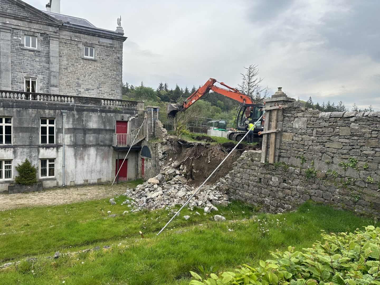
An external retaining wall south-east of Westport House, Westport Demesne, Co. Mayo partially collapsed and required urgent repair to prevent further collapse and to make the area safe. Archaeological monitoring was undertaken of the groundworks to facilitate this repair. The house itself, a detached seven-bay (five-bay deep) two-storey over raised basement country house, designed 1731, built 1732-4, is a Recorded Monument (MA088-008002-).
The wall in question, which is likely to be 18th or 19th century in date, extends from the south-east corner of Westport House; it runs almost due south, separating a higher-level lawn and planted area to the south of the eastern avenue approach to the entrance of the house, and the lower-level terraced gardens to the south of the house.
Repairing the collapse unavoidably included excavating some of the soil from behind the wall. The overall length of collapsed wall was approximately 9.5m and the height of the wall would have been approximately 4.8m. The wall, which was aligned from north to south, was composed of coarsely shaped, rectangular, limestone blocks that were mortared together. The remedial works to the collapsed wall were archaeologically monitored on 3 and 4 May 2023 and included the removal of the collapsed stone wall material and digging out of earthen material which had been retained by the wall prior to its collapse.
A 13-tonne tracked excavator was initially used to remove trees that stood at the east of the wall. Topsoil was then stripped for approximately 8m to the east of the collapsed wall. The topsoil was approximately 0.2m thick and was observed to overlay naturally deposited geology of very pale greyish-brown sandy glacial till with frequent large limestone boulders and smaller limestone pieces. These natural geological deposits were exposed for a distance of approximately 8m eastwards from the wall and vertically for a depth of approximately 3m.
No archaeological features, deposits or artefacts were present. This might seem surprising considering the proximity of Westport House and its gardens but it was clear that the base of the house and its garden on the south were terraced into natural geological deposits.