2023:576 - DROGHEDA-BALTRAY FLOOD RELIEF SCHEME, Louth
County: Louth
Site name: DROGHEDA-BALTRAY FLOOD RELIEF SCHEME
Sites and Monuments Record No.: LH024-041
Licence number: 23E0486
Author: Liam Coen c/o Courtney Deery Heritage Consultancy
Author/Organisation Address: Lynwood House, Ballinteer, Dublin 16
Site type: No archaeology found
Period/Dating: N/A
ITM: E 709370m, N 775299m
Latitude, Longitude (decimal degrees): 53.715893, -6.343050
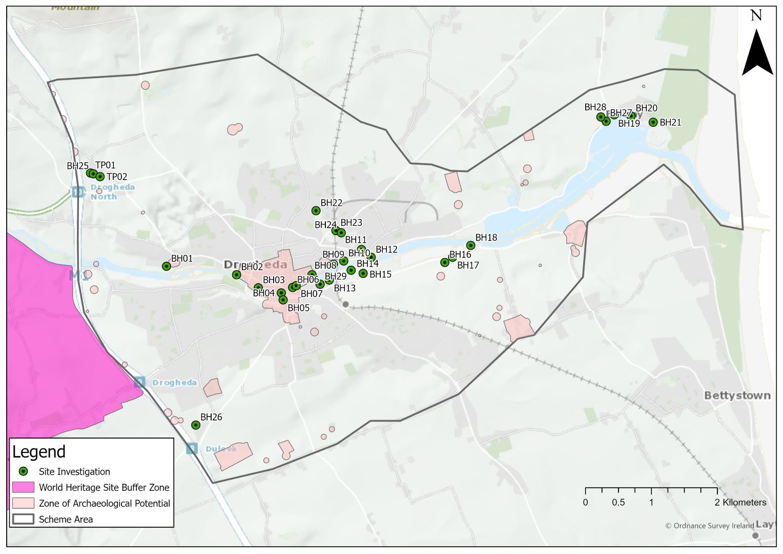
Archaeological monitoring of geotechnical site investigations was undertaken in advance of the Drogheda-Baltray Flood Relief Scheme (FRS). Site investigations were archaeologically monitored under licence with metal detection of risings under licence 23R0257. An Archaeological Impact Assessment was prepared in advance of Site Investigations (SI) and was approved by the Project Archaeologist and Client.
The proposed FRS Scheme Area is centred on the town of Drogheda and the village of Baltray in County Louth. The Scheme Area also includes part of County Meath, but the majority of works took place in Louth. The proposed SI locations were in the townlands of Mell, Moneymore, Lagavooren, Yellowbatter, Newtownstalaban, Banktown, Braghan and Baltray in Louth, and Stagrennan and Stameen townlands in Meath.
The investigations comprised 29 Cable Percussion Boreholes (BH) and two Machine Excavated Trial Pits (TP), of which all but one borehole (BH05) was completed. Soakaway pits were also excavated adjacent to the two test pits. No archaeological features were identified, but evidence of reclamation deposits were revealed in BH03, BH06, BH07, BH08 and BH09 as anticipated, up to a depth of 2.8m deep. Should earth moving works be required in these areas as part of the flood relief scheme, it is likely that archaeological features or deposits will be identified. Two sherds of a late medieval or early modern sherd of local ware were recovered from BH03, and a single sherd of 19th-century ceramic was found at TP01. Metal detection revealed a number of modern pieces of metal which were not of archaeological interest. Micrositing brought BH24 within the footprint of Newfoundwell Mill and c.10m from the millrace, but there was no evidence of sub-surface features; however, the heavy contamination of an alluvial deposit may result from the period when the mill was in use.