2023:229 - ARDEE: Tierney Street, Dawsonsdemesne, Louth
County: Louth
Site name: ARDEE: Tierney Street, Dawsonsdemesne
Sites and Monuments Record No.: LH017-101
Licence number: 21E0396 and 22R0098
Author: Caroline Cosgrove, Archaeological Consultancy Services Unit
Author/Organisation Address: Unit 21, Boyne Business Park, Greenhills, Drogheda, Co. Louth
Site type: Historic town
Period/Dating: Late Medieval (AD 1100-AD 1599)
ITM: E 696296m, N 790608m
Latitude, Longitude (decimal degrees): 53.855994, -6.536265
Archaeological monitoring was carried out on the site at Tierney Street, Ardee, Co. Louth, east of Barn Hill, in the eastern part of Ardee town, in Dawsonsdemesne townland, in Co. Louth. The site is situated east of Tiernan Avenue estate and south of a disused railway station. A long rectangular cottage was located within the north-western extent of the site and demolished as part of the proposed development.
The southern extent of this site was monitored in July 2021 and although part of a separate planning application, is part of this current development/same site. It was monitored under licence 21E0395.
The site is located within the Zone of Archaeological Potential associated with Ardee town (LH017-101-). A Castle – tower house known as ‘The Courthouse’ is located c. 158m to the west of the site. The nearest recorded monuments to the site are two pottery kilns (LH017-101030 and LH017-101031). These were identified in the plot adjacent to and east of the site.
Monitoring of topsoil stripping was carried out on site intermittently between August 2021 and February 2023. A 14-tonne tracked excavator with a graded bucket stripped the topsoil down to natural or onto the top of any identified archaeological deposits. The topsoil, C1, was a dark brown silty clay with frequent roots and it contained both domestic and garden waste. It had a depth of up to 1m. The natural, C2, was a compact orangish-brown boulder clay. It had a crisscross of field drains and agricultural furrows that contained 18th/19th-century pottery with occasional red brick.
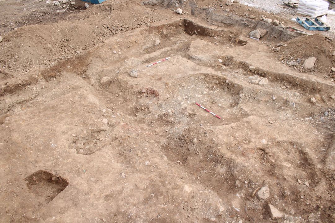
Archaeological features were recorded in the centre of the site. The features exposed include 8 ditches (C100, C104, C117, C120, C167, C176, C178, and C193), 6 cereal-drying kilns (C103, C123, C127, C158, C162 and C204), 9 pits (C105, C124, C138, C146, C154, C180, C183, C195 and C198), 1 spread (C111) and 3 post-holes (C147, C149 and C151). The proposed development would have directly impacted these features, therefore, it was agreed to preserve the features by record (excavate).
A total of 197 sherds of pottery were recovered from the features on site, dating the activity to the Late Medieval Period. The activity was likely associated with kilns (LH017 -101030 and LH017-101031) which were excavated to the east of the site in 2002.
At the north/northwest of the site, features associated with the recently demolished cottage were identified. To the east of the site, a rectangular concrete structure was cut into the natural, truncating the east-to-west aligned ditches C104, C117 and C120.
All archaeological features have been resolved. Post-excavation analysis is ongoing. No further input is required on-site.