2023:600 - BARRYSFARM, Hospital, Limerick
County: Limerick
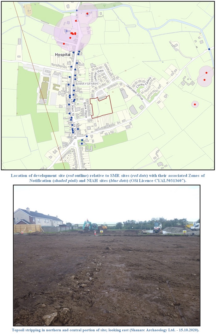
Site name: BARRYSFARM, Hospital
Sites and Monuments Record No.: N/A
Licence number: 20E0089
Author: Emer Harington, Seán Shanahan & Michael Greiner; Shanarc Archaeology Ltd.
Author/Organisation Address: Unit 39a, Hebron Business Park, Hebron Road, Kilkenny
Site type: No archaeology found
Period/Dating: N/A
ITM: E 570771m, N 635773m
Latitude, Longitude (decimal degrees): 52.472606, -8.430218
Archaeological monitoring of topsoil stripping, and development-related excavations associated with the construction of a social housing development in Barrysfarm, Hospital, Co. Limerick were carried out between 13 August 2020 and 25 July 2023. Archaeological monitoring during construction was part of an approved mitigation strategy required by Limerick City and County Council in respect of the development of the site.
A previous archaeological assessment of the site was conducted in 2016 by John Cronin and Associates, followed in 2018 by archaeological testing by the same company, under excavation licence no. 18E0176, along with licensed metal detecting (Detection Licence No. 18R0060). During this investigation a cluster of features with archaeological potential were uncovered in the south-east corner of the site. This cluster extended 10m, radiating in all directions from the central point (ITM 570793, 635643). This cluster, which contained possible pits, post- and stake-holes, was fenced off and preserved in situ; it was not disturbed during the subsequently monitored development works.
The purpose of monitoring of the topsoil stripping was to identify and record any further features of archaeological potential that might be exposed, and impacted by the development at the site.
Monitored works comprised service trench excavations, topsoil stripping across the majority of the site, excavations associated with boundary treatments and footpath realignments, and excavation of a wastewater treatment/septic tank area. The stratigraphy of excavated material was consistent across all excavated areas of the site, and comprised c. 0.25–0.4m of topsoil overlying natural orangey to mid-brown clay, with occasional bedrock exposed at depths below 1m.
The area towards the southeast of the site, where archaeological features had been identified during previous archaeological testing (Excavation Licence No. 18E0062), was fenced off for the duration of the monitored development works, and no groundworks took place in this area of the site.
No archaeological finds, features or deposits were identified during any of the monitored groundworks across the site.