2023:261 - SHANNONGROVE, Pallaskenry, Limerick
County: Limerick
Site name: SHANNONGROVE, Pallaskenry
Sites and Monuments Record No.: LI003-016
Licence number: 23E0223
Author: Michael Greiner & Seán Shanahan; Shanarc Archaeology Ltd.
Author/Organisation Address: Unit 39A, Hebron Business Park, Hebron Road, Kilkenny
Site type: No archaeology found
Period/Dating: N/A
ITM: E 541019m, N 657084m
Latitude, Longitude (decimal degrees): 52.661727, -8.871882
Archaeological monitoring was carried out in June 2023, of groundworks associated with the proposed construction of a private residential dwelling on a c. 0.4 acre greenfield site at Shannongrove, Pallaskenry, Co. Limerick.
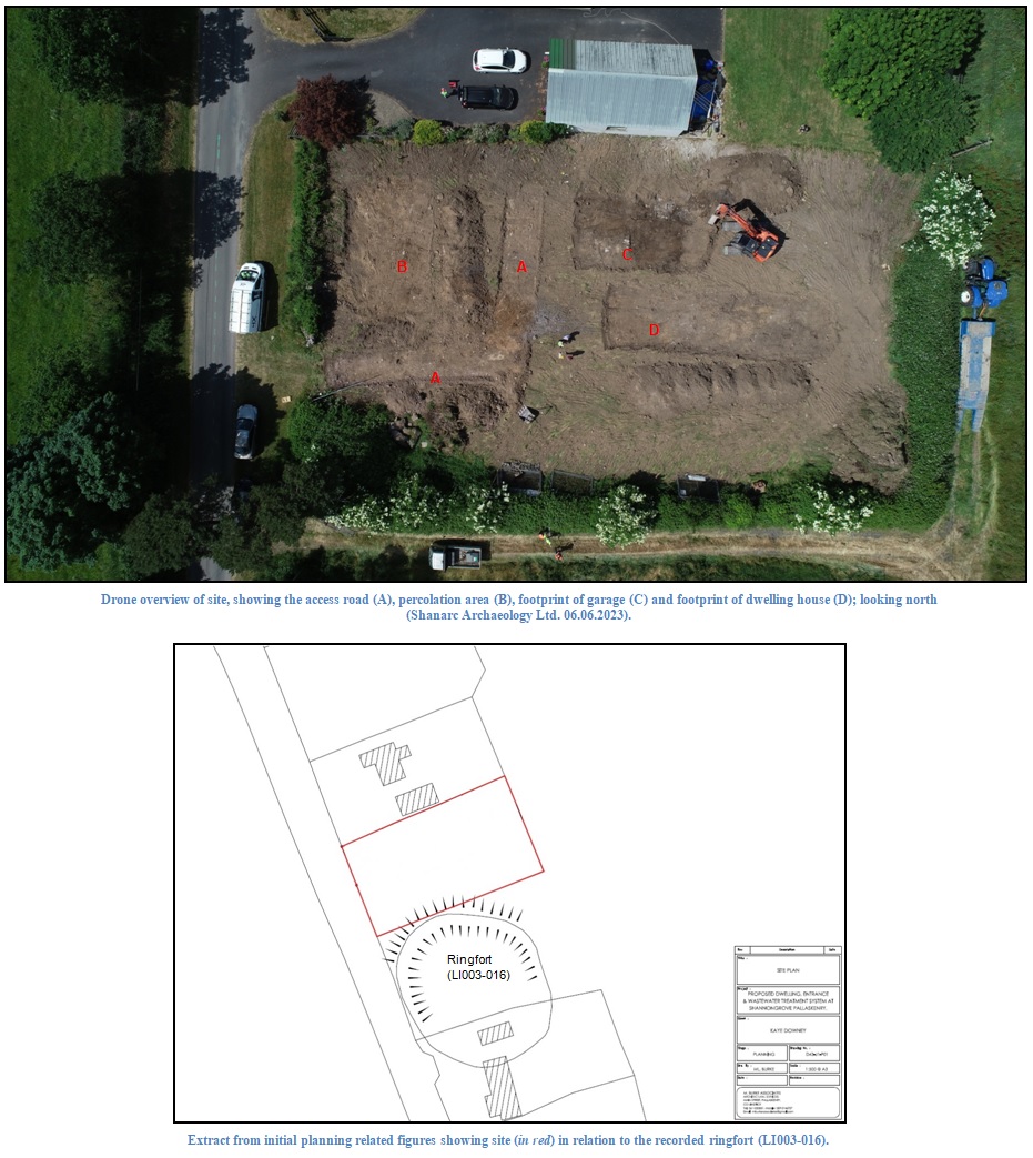
The archaeological potential of the subject site arises from the proximity of the proposed development to ringfort-rath LI003-016, the Zone of Notification for which encapsulates the area of the proposed development.
The site was previously subjected to archaeological test-excavations under licence No. 21E0799. In spite of the fact that archaeological test-excavations produced no evidence for archaeology at the site, the final grant of planning maintained the requirement for the archaeological monitoring of all groundworks associated with the proposed development.
Monitored works included site clearance, as well as soil-stripping to natural levels in the footprints of the proposed access road, percolation area, garage and dwelling house.
The access road was stripped to a depth of 0.2m where the underlying subsoil, a light orange-brown, moderately compact, sandy silt with a moderate amount of small and medium sized sub-rounded stones, was exposed; the same stratigraphy was recorded in all excavated areas of the site. The driveway extended from the existing site entrance on the western side of the site, approximately 10m north of the field boundary to the south, curving northwards where it stops approximately 3m from the northern site boundary.
The percolation area was a rectangular area situated in the north-west corner of the site adjacent to the roadway. The area measured approximately 4m in width (east-west), by 8m in length, and was stripped to a depth of 0.25m.
The garage footprint was situated in the centre of the site, close to the northern site boundary. The garage area measured 12.6m in length (east-west) by 5.2m, and was stripped to a depth of 0.3m.
The area comprising the house footprint was located at the centre of the site. This area measured 6.4m in width (north-south), by 19.4m in length, and was excavated to a depth of 0.42m.
No archaeological finds, features or deposits were identified during the monitored groundworks.