2023:233 - BARNAKYLE, Patrickswell, Limerick
County: Limerick
Site name: BARNAKYLE, Patrickswell
Sites and Monuments Record No.: N/A
Licence number: Unlicensed Monitoring
Author: Grace Fegan & Robert Hanbidge; Shanarc Archaeology Ltd.
Author/Organisation Address: Unit 39A, Hebron Business PArk, Hebron Road, Kilkenny
Site type: No archaeology found
Period/Dating: N/A
ITM: E 552520m, N 650274m
Latitude, Longitude (decimal degrees): 52.601651, -8.700906
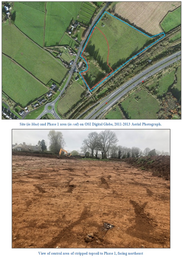
Unlicensed archaeological monitoring of ground reduction works associated with Phase 1 of a residential development at Barnakyle, Patrickswell, Co. Limerick was carried out in April 2023 to fulfil archaeological conditions as required by Limerick County Council in their grant of Conditional Planning Permission in 2018.
This residential development has received three grants of conditional planning permission. A Request for Further Information regarding one of them stipulated that an archaeological impact assessment be carried out, including the results of archaeological test excavations. These works were carried out by Seán Shanahan under licence 18E0330 in 2018; twenty-two archaeological test trenches were excavated across the entire development plot and an assessment of relevant and readily available archaeological and built heritage records was undertaken. Nothing of any archaeological significance was uncovered during the assessment.
The current phase of monitoring comprised the mechanical removal of topsoil from within the footprint of the Phase 1 area. The topsoil varied in depth between 0.10–0.35m and was deepest to the northern portion of this Phase 1 area. The natural subsoil over the majority of the site consisted of a mid-orange brown sandy clay with frequent inclusions of medium-sized angular stones and occasional inclusions of large-sized stones and boulders.
A relict field boundary (which is visible in the OSi historical mapping and in pre-2010 aerial imagery) was visible running northwest-southeast across the site. There was also evidence for modern burning, refuse and building rubble both in the south-west and north-west corners of the site, adjacent to modern dwellings. A concrete structure and a water trough were exposed in the centre of the site. Test trenches associated with licence 18E0330 were also visible crossing the exposed area.
No features, deposits or finds of archaeological significance were identified during this initial phase of archaeological monitoring.
This development is subject to a phased programme of construction with subsequent later phases of ground works also requiring full archaeological monitoring in order to have compliance with the received grant of Conditional Planning Permission.