2023:030 - CLONCONANE (Phase 2), Limerick
County: Limerick
Site name: CLONCONANE (Phase 2)
Sites and Monuments Record No.: N/A
Licence number: 23E0034
Author: Peter Looney
Author/Organisation Address: 3a Westpoint Trade Centre, Link Road, Ballincollig, Cork
Site type: Enclosure
Period/Dating: Undetermined
ITM: E 555130m, N 659258m
Latitude, Longitude (decimal degrees): 52.682616, -8.663601
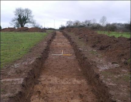
A geophysical survey (Licence 22R0379) undertaken on this site in November 2022 identified a number of anomalies of potential archaeological significance. A programme of archaeological testing to target these anomalies was undertaken in January/February 2023. The programme of testing involved the excavation of eighteen linear test trenches with a combined length of 585 metres. Natural subsoil was identified at a depth of 0.15m to 0.6m. Archaeological features were identified in three of the trenches, while potential archaeological material was identified in three other trenches. The archaeological material found consists of a circular enclosure, likely a ringfort, as well as four pits/post-holes on the interior of this enclosure and one pit outside it.
A semi-circular feature, comprising the southern half of a ring-shaped anomaly, was identified from the geophysics results in the north-centre of the surveyed area. Two trenches were positioned to target this anomaly. Portions of an infilled ditch were located on the three points of these trenches where the geophysics had indicated. These ditch sections were 3.5m to 4.5m wide.
This feature bears all the hallmarks of a levelled ringfort. This feature measures c.29m in internal diameter and c.37m in external diameter (the east to west trench crossed the anomaly below its centre, so the true diameter will be marginally greater). This is within the usual range of a ringfort and is located on a raised portion of the field. None of the internal features noted were within c.4m of the ditch, allowing space for an internal bank.
If the ring does continue to the north, to form a complete circle, the northern part would be in the area of an extant field boundary and thus was not within the area of the geophysical survey or the test trenches. The field boundary in that location is kinked and may partly respect the curvature of the feature. There was nothing in this area depicted on the historic Ordnance Survey (OS) maps, meaning that the feature was levelled prior to 1840.
Additional features were identified within the area surrounded by the curvilinear ditch which may relate to contemporary activity within this feature. These consist of four small pits or post-holes. Some linear features were also noted (though these may relate to later agriculture).
An isolated pit, containing charcoal and burnt bone, was also identified, it measures 0.37m x 0.32m. This was located c.32m to the southwest of the possible ringfort.
A number of infilled ditches were identified in four of the trenches. These had been identified from the results of the geophysical survey. Slots were put through these in three places, but nothing was recovered that would provide a date. They were not represented on the historic OS maps, so are likely to predate 1840. As they are in close proximity to likely early medieval activity (possible ringfort) there is potential that they also date to this period.