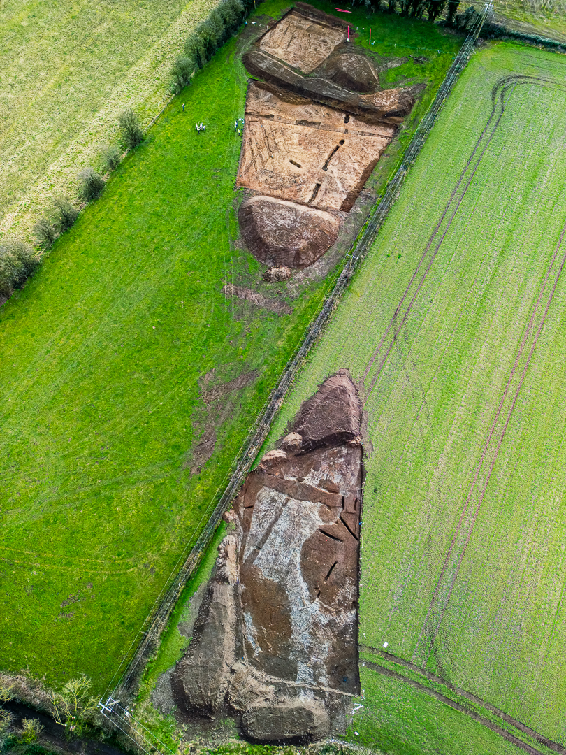
2023:416 - BALLYCONRA (2–4), Kilkenny
County: Kilkenny
Site name: BALLYCONRA (2–4)
Sites and Monuments Record No.: N/A
Licence number: 23E0096; 23R0052
Author: John Channing, c/o Archaeological Management Solutions
Author/Organisation Address: 12 Parliament Street, Kilkenny, R95 Y2HE
Site type: Field system
Period/Dating: Multi-period
ITM: E 643370m, N 673105m
Latitude, Longitude (decimal degrees): 52.807185, -7.356752
Stage (iii) Excavations were undertaken at Ballyconra 2–4 as part of the N77 Ballyragget Village to Ballynaslee Road Improvement Scheme, Co. Kilkenny.
Ballyconra 2–4 consisted of a relict field system, agricultural furrows and natural glaciofluvial features. The extent of the site was assessed during Stage (i)a Test Excavations undertaken in 2022 by AMS (Channing 2023). The on-site Stage (iii) Excavation Services at Ballyconra 2–4 were conducted between 3–20 February 2023.
The site of Ballyconra 2 consisted of two linear ditches together with a possible pit, agricultural furrows and a geological feature initially identified as a possible ring-ditch in a geophysical survey carried out by Earthsound Archaeological Geophysics (EAG) in 2018 (Licence No. 18R0092; Gimson & Hogan 2018).
Ballyconra 3 consisted of two linear ditches together with agricultural furrows. An isolated feature resembling a kiln in plan was also excavated. The fill appeared sterile, however charcoal flecks were retrieved from soil samples retained from this feature. Ballyconra 4 consisted of an east–west orientated ditch and agricultural furrows.
References
Channing, J. 2023. N77 Ballyragget Village to Ballynaslee Road Improvement Scheme: Stage (i)a and Stage (i)f Report. Unpublished report by Archaeological Management Solutions on behalf of Kilkenny County Council.
Gimson, H. & Hogan, C. 2018. N77 Ballyragget Village to Ballynaslee Road Improvement Scheme, County Kilkenny Archaeological Consultancy Services Contract Stage (i) Geophysical Survey. Unpublished report by Earthsound Archaeological Geophysics for Kilkenny County Council.

