2023:422 - TULLAMORE, Listowel, Kerry
County: Kerry
Site name: TULLAMORE, Listowel
Sites and Monuments Record No.: N/A
Licence number: 23E0450
Author: David Murphy
Author/Organisation Address: 3a Westpoint Trade Centre, Link Road, Ballincollig, Cork
Site type: Burnt spread
Period/Dating: Prehistoric (12700 BC-AD 400)
ITM: E 499660m, N 638706m
Latitude, Longitude (decimal degrees): 52.490525, -9.477529
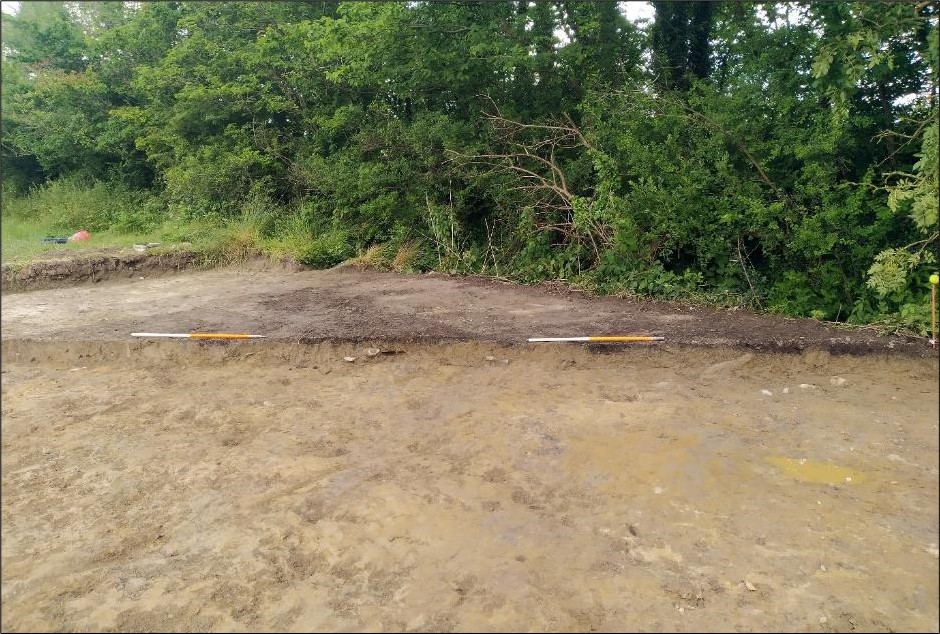
The excavation programme emanated from the revealing of a burnt spread-type archaeological site in the east-central portion of the Tullamore solar farm site during a programme of archaeological testing (Excavation Licence No. 23E0046) undertaken at the solar farm site in March 2023.
The burnt spread material was composed of a sporadic deposit of heat-affected stone fragments contained within a moderate to firmly compacted, charcoal-rich clayey silt and measured between 60mm and 90mm thick. The burnt material both overlay, and was intermixed with, a well-compacted, light brownish-grey silty clay which had the appearance of being a redeposited soil. The combined deposits measured c 8.75m (north-south) by 6.9m, with a maximum thickness of 0.36m. The discovery of a sherd of early modern pottery within the clayey silt which underlay the burnt material confirmed its ex-situ status.
The burnt material had been removed from its original context by agriculture or land improvement- related activity. A deep and wide drainage ditch extended north-east/south-west to the immediate southeast of the spread.
Nevertheless, the presence of the burnt material at the site is indicative of archaeological activity, quite probably dating to the late prehistoric period (c. 2400 BC–AD 400), having taken place in the immediate area surrounding the site.