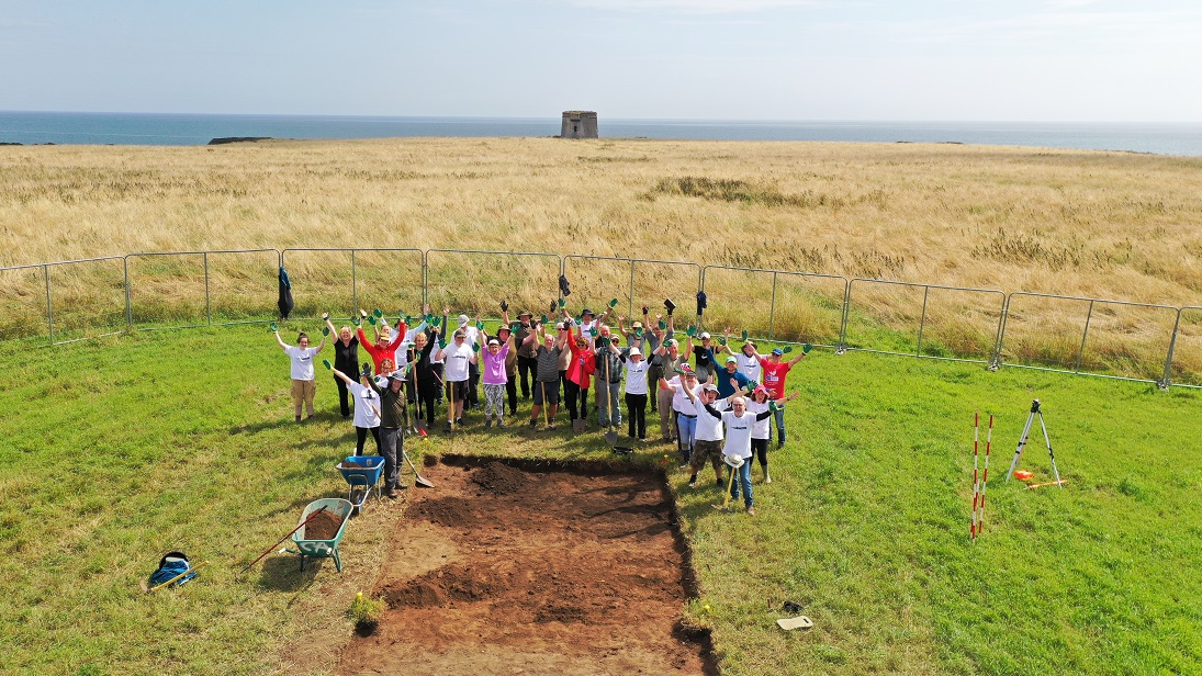
2023:282 - Drumanagh, Dublin
County: Dublin
Site name: Drumanagh
Sites and Monuments Record No.: DU008-006001
Licence number: C786; E4805
Author: Christine Baker
Author/Organisation Address: Heritage Officer/Archaeologist, Fingal County Council, Main St. Swords, Co. Dublin
Site type: Promontory fort - coastal
Period/Dating: Iron Age (800 BC-AD 339)
ITM: E 727104m, N 756123m
Latitude, Longitude (decimal degrees): 53.539649, -6.082363
Season IV of the Digging Drumanagh–Fingal Community Excavation Project.
Excavation took place over 13 days between 19 July and 02 August 2023. An area encompassing Season III and Season IV was subject to geophysical survey (Licence Ref R0000614, Bonsall 2023). There was a contrast between the geophysical results and the topography and given the disparity between the topographical features and the geophysical survey results the objective of the 2023 excavation was to establish the veracity of the geophysical survey results and examine the topography in relation to the survey results.
An excavation trench, divided into Trenches 5A and 5B, was opened 9m apart on the same alignment in order to investigate the contrast between the geophysical survey results and the topography. Trench 5A measured 15m east-west x 4m in width and was located to investigate the geophysical results which included a possible kiln and series of pits. The topography in this area also rose distinctly but gradually. On the same alignment 9m west Trench 5B measured 7m east-west x 4m in width and although there were limited survey results in this area, there was a distinct hollow reminiscent of that in Trench 4 which, on excavation, transpired to be a structure.
Prehistoric activity and artefacts dominate Trench 5A and 5B. On the higher ground to the east shallow pit activity is capped with a layer of large stones and topped with a stone deposit. In the lower-lying hollow to the west the remains of a structure, capped by large stones, was comparable with two others identified in previous seasons of excavation. A specific typology of structure appears to be merging in Trenches 3, 4, and 5B. All are cut/overlying natural subsoil and the elements – basal metalled surface, possible entrance to the north with attendant post-hole, sloping internally, large flags, Romano-British artefacts from internal layers – are notably similar.
The use of large stones and smaller stone deposits to cap or delineate and area of activity also extended into Trench 5A. In contrast to the hollows relating to at least two of the three structures described previously, the stone area in Trench 5A was a relative high point within the surrounding topography. The underlying activity -cultural layers and shallow pits – extended beyond the area defined by the stones. So while there were a number of closely-set shallow pits immediately under the area defined by stone, there was also shallow pits of similar morphology to the east and west of the area. Material of probable Iron Age date and artefacts of Romano-British origin were present in these deposits.
Appearing as the most consistent on the geophysical survey, two large bell-shaped pits were uncovered in Trench 5A. The steep-sided circular pits (1.8m max. diam.) were not fully excavated and had been cut/recut and subsequently used as waste pits. These were rich with animal bone, charcoal and artefacts including bone comb, bone pins, bone scoop, spindle whorl, antler off-cuts, as well as a ceramic weight and glass ball. Post-excavation analysis is ongoing.

