2023:052 - MOORETOWN, Swords, Dublin
County: Dublin
Site name: MOORETOWN, Swords
Sites and Monuments Record No.: N/A
Licence number: 22E0586
Author: Gill McLoughlin, c/o Courtney Deery Heritage Consultancy
Author/Organisation Address: Lynwood House, Ballinteer Road, Dublin 16
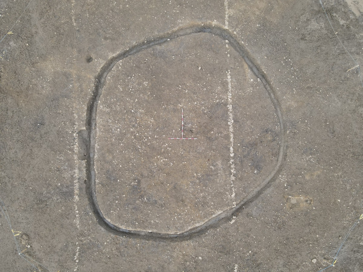
Site type: Ring-ditch and Burnt spread
Period/Dating: Prehistoric (12700 BC-AD 400)
ITM: E 716106m, N 747914m
Latitude, Longitude (decimal degrees): 53.468457, -6.251240
Archaeological monitoring carried out in October–November 2022 uncovered two sites which were subsequently fully excavated in January–February 2023. The work related to a permitted housing development.
Two areas of archaeological interest were identified during monitoring: a small sub-circular ditched enclosure and a burnt spread.
The enclosure had an internal diameter of 13m and the ditch measured a maximum of 0.9m wide and 0.6m deep. There was no entrance to the enclosure and a general lack of finds or environmental material retrieved from the ditch fills. The lack of any associated features or environmental evidence normally associated with habitation would suggest that it is unlikely to have been related to settlement. The lack of an entrance may support the idea of a ceremonial function and it is likely to be a type of ring barrow, classified as a ring-ditch, due to the lack of any above ground features such as a bank or associated mound. A sample of uncharred bramble seeds recovered from a lower fill of the enclosure ditch was radiocarbon dated and indicated an early medieval date for the site, between the late 7th and late 9th Centuries (684–884 AD).
The burnt spread was irregular in plan and filled a broad shallow cut measuring a maximum of 22m north-south x 4.5m. The spread was quite linear and appeared to be the remnants of a burnt spread settled into a hollow, the remainder of which had been ploughed away. Radiocarbon dating of charcoal from this site has been dated to the late Bronze Age (1108–911 BC).