Customize Consent Preferences

We use cookies to help you navigate efficiently and perform certain functions. You will find detailed information about all cookies under each consent category below.

The cookies that are categorized as "Necessary" are stored on your browser as they are essential for enabling the basic functionalities of the site. ... 

Always Active

Necessary cookies are required to enable the basic features of this site, such as providing secure log-in or adjusting your consent preferences. These cookies do not store any personally identifiable data.

No cookies to display.

Functional cookies help perform certain functionalities like sharing the content of the website on social media platforms, collecting feedback, and other third-party features.

No cookies to display.

Analytical cookies are used to understand how visitors interact with the website. These cookies help provide information on metrics such as the number of visitors, bounce rate, traffic source, etc.

No cookies to display.

Performance cookies are used to understand and analyze the key performance indexes of the website which helps in delivering a better user experience for the visitors.

No cookies to display.

Advertisement cookies are used to provide visitors with customized advertisements based on the pages you visited previously and to analyze the effectiveness of the ad campaigns.

No cookies to display.

Excavations.ie

2023:000 - Knockaneady, Cork

NMI Burial Excavation Records

County: Cork

Site name: Knockaneady

Sites and Monuments Record No.: CO109-02201

Licence number: 22E0740

Author: Tony Miller

Site type: No archaeology found.

Period/Dating: Post Medieval (AD 1600-AD 1750)

ITM: E 534345m, N 553409m

Latitude, Longitude (decimal degrees): 51.729189, -8.950441

Missing Mapbox GL JS CSS

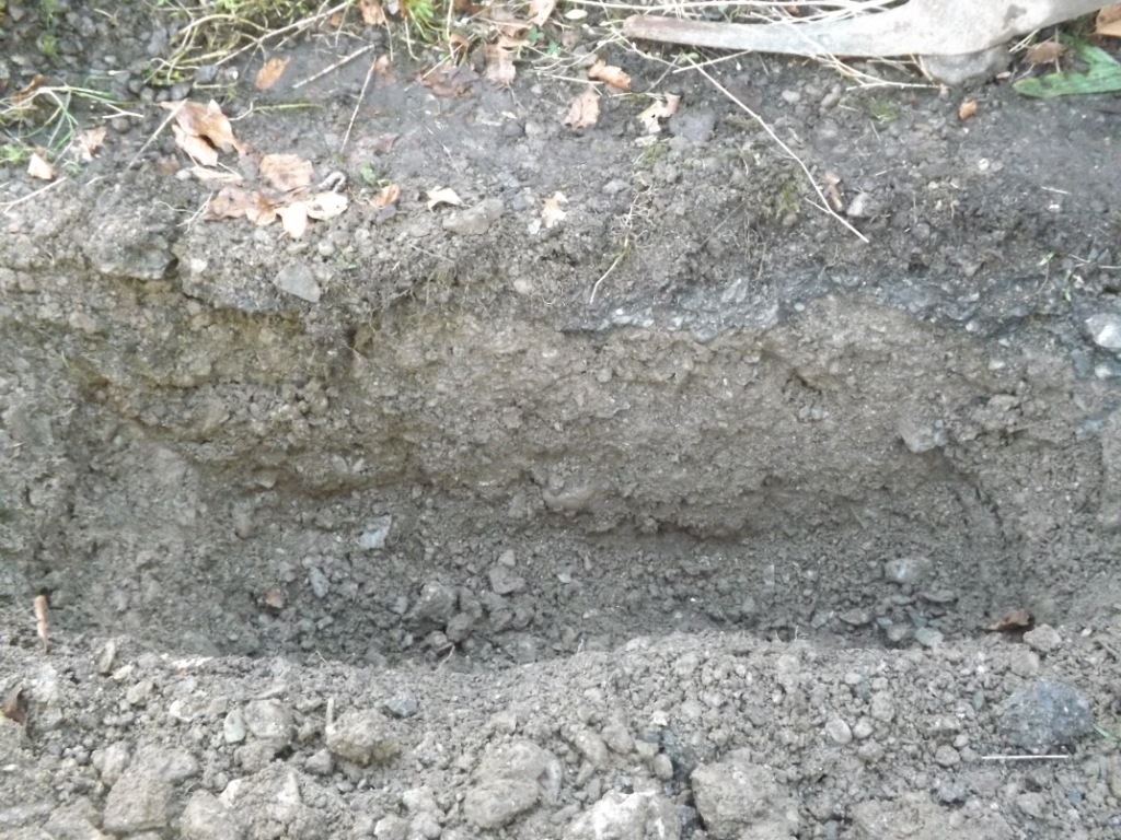
Ballineen and Enniskeane Tidy Towns were given permission to erect signage just outside the northern entrance to Ballymoney Old Graveyard and church. They are situated in Knockaneady, to the south of the River Lee and village of Ballineen. Two information boards were placed adjacent to the entrance, in an area which was, until recently, a surfaced road. Each sign required a hole 1m in length by 0.35m wide and 0.4m deep, the digging of which had to be monitored due to their proximity to the graveyard.
The stratigraphy of the southern hole was 0.1m of gravel and tarmacadam overlying natural grey gravels. The second hole, immediately north of the first, revealed a stratigraphy of gravel and tarmacadam overlying scattered field stones which in turn overlay natural grey gravels. The stones would appear to have been unused remnants from the building of a enclosing wall around the adjacent 19th-century Church of Ireland church.
No finds or features were recorded.

2023:000 - Knockaneady, Cork