2023:246 - BALLYSALLAGH EAST, Newmarket-on-Fergus, Clare
County: Clare
Site name: BALLYSALLAGH EAST, Newmarket-on-Fergus
Sites and Monuments Record No.: N/A
Licence number: 23E0231
Author: Kate Taylor, TVAS (Ireland) Ltd.
Author/Organisation Address: Ahish, Ballinruan, Crusheen, Co. Clare
Site type: Structure
Period/Dating: Modern (AD 1750-AD 2000)
ITM: E 537310m, N 667610m
Latitude, Longitude (decimal degrees): 52.755905, -8.928709
Archaeological monitoring was undertaken at the site of a single house development in the townland of Ballysallagh East, Newmarket-on-Fergus. The 0.345ha development site consisted of a field in pasture with two ruined buildings, pre-dating the 1st edition Ordnance Survey map surveyed in 1838.
The two ruined structures present on the site were both approved for demolition and clearance to facilitate the construction of the new residential building. The entire footprint of the development was monitored during groundworks and stripping of topsoil. Details of both structures scheduled for clearance were recorded.
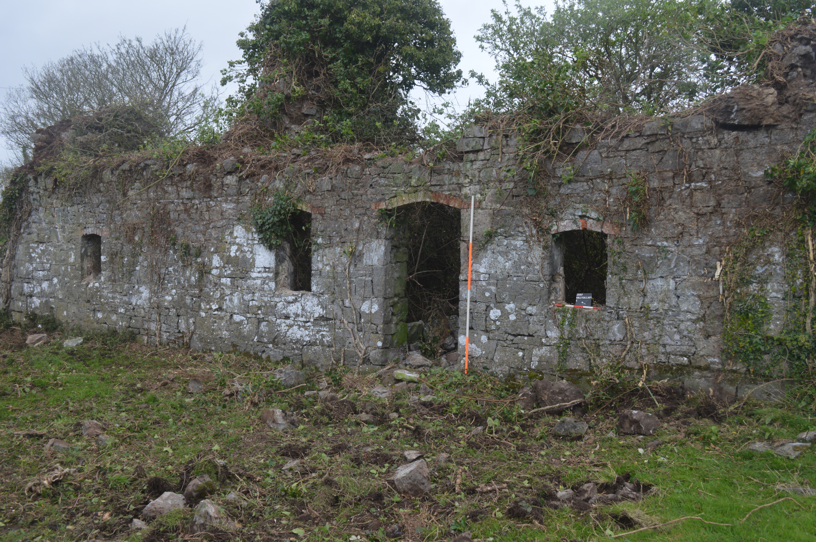
Structure 1 stood on the north-western side of the development site and was aligned south-east to north-west. This building was constructed of good quality stone, the windows and two doorways had brickwork arches. A central door flanked by two large windows with dressed stone sills was found on the north-eastern face of the building, with three smaller windows and a door on the south-western face that opened into the yard between the buildings. The structure had two notable rooms, either side of a central chimney. The room at the north-western end of the structure had a small fireplace made from local red brick and two wall recesses; remnants of plaster were evident above the fireplace. The south-eastern room was entered via a short hallway on the south side of the chimney, it contained a brick-arched fireplace, larger than that in the north-western room. Sockets for joists were noted in the gable. Following demolition the ground was cleared, revealing clean natural subsoil.
Structure 2 lay a short distance south-west of Structure 1 and was orientated on the same alignment. This structure was smaller and less substantial; it appears to have been a shed or outbuilding. Following demolition the ground was cleared, revealing clean natural subsoil.
A well-cut stone wall connected the two buildings at the south-east, so a yard was formed between the structures. This area, measuring 19m by 18m, was stripped of topsoil to a depth of 0.4m onto mixed stone and limestone bedrock.
No features or finds of archaeological significance were observed across the entire site.