2022:674 - CRANAREEN, Wicklow
County: Wicklow
Site name: CRANAREEN
Sites and Monuments Record No.: N/A
Licence number: Unlicenced Monitoring
Author: Jamie Lewis; Shanarc Archaeology Ltd.
Author/Organisation Address: Unit 39a, Hebron Business Park, Hebron Road, Kilkenny
Site type: No archaeology found
Period/Dating: N/A
ITM: E 698718m, N 688051m
Latitude, Longitude (decimal degrees): 52.934184, -6.531532
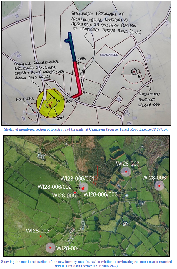
Unlicensed archaeological monitoring was carried out in relation to groundworks associated with the creation of a section of new forestry road within existing forestry lands at Cranareen, Co. Wicklow.
The forest road development does not directly encounter any Recorded Monuments/SMR sites, however, there are several recorded archaeological features within the vicinity of development. These include an enclosed graveyard containing a cross and a font (WI028-006001/2/3) situated 85m to the south-west, and an enclosure (WI028-007) situated 320m to the east of the development; as a result a condition of archaeological monitoring was attached to the associated Forestry Road Licence CN 87715.
In line with Forest Road Licence CN87715, ground reductions, drainage works and stump removal were archaeologically monitored.
Works were undertaken within the corridor from south to north. The route was initially oriented north-north-east/south-south-west and continued for c.125m before turning slightly to be orientated north-south for the remaining 100m. The width of the corridor was approximately 20m.
Throughout all monitored works the stratigraphy remained the same, comprising dark brown topsoil heavily mixed with pine needles, between 0.25m to 0.35min thickness. Below the topsoil was a natural marl or clay that varied in colour from yellow to blue-grey
No features, deposits or finds of archaeological significance were identified during archaeological monitoring.