2022:659 - KELSHABEG, Wicklow
County: Wicklow
Site name: KELSHABEG
Sites and Monuments Record No.: N/A
Licence number: Unlicenced Monitoring
Author: Robert Hanbidge; Shanarc Archaeology Ltd.
Author/Organisation Address: Unit 39a, Hebron Business Park, Hebron Road, Kilkenny
Site type: No archaeology found
Period/Dating: N/A
ITM: E 694233m, N 688251m
Latitude, Longitude (decimal degrees): 52.936786, -6.598168
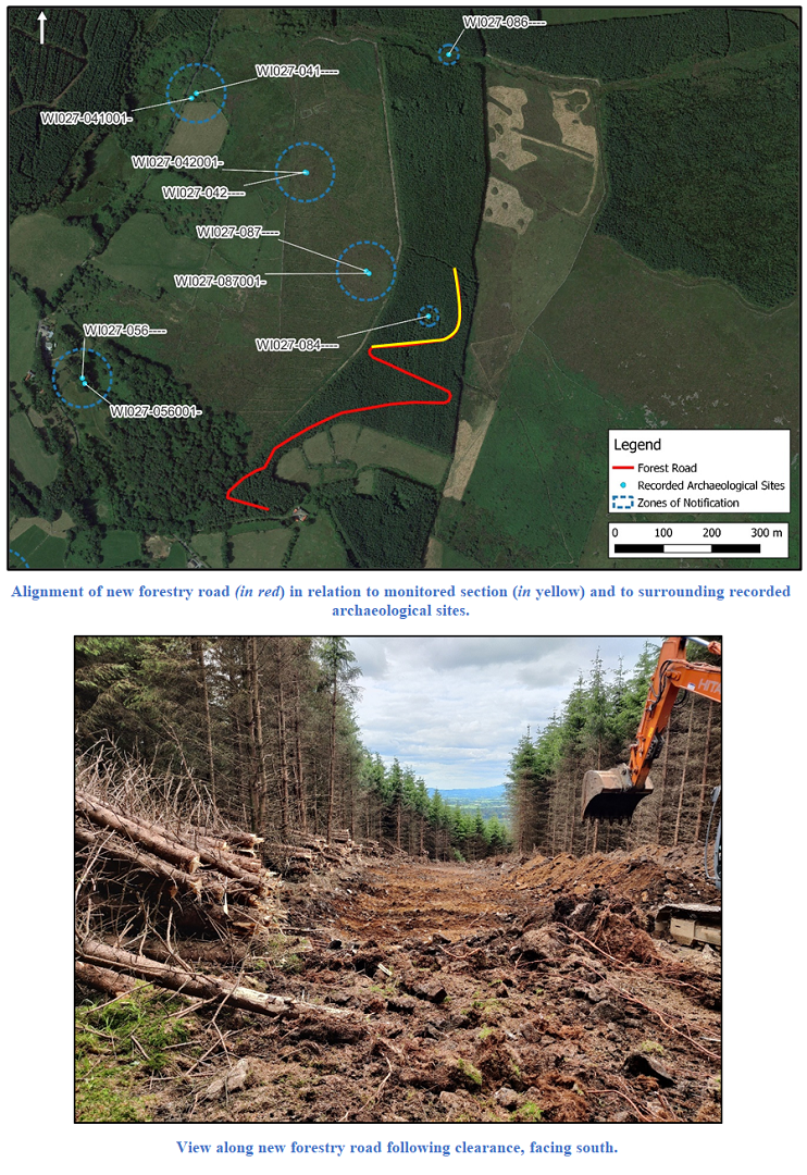
Unlicensed archaeological monitoring was carried out of groundworks associated with the creation of a section of new forestry road within existing Coillte forestry lands at Kelshabeg, Co. Wicklow.
The northern section of new forestry road was routed to avoid a Recorded Monument, hut site WI027-084, including a 30m exclusion zone around the site. All earthworks/excavations associated with the forestry road within 100m of the hut site were required to be monitored as a condition of the Forest Road Licence CN 84980.
Prior to ground reduction works, it was necessary to clear the trees from the route of the forestry road. Drainage channels were dug to either side of the new road. Topsoil consisted of a thick layer (0.4m deep) of black organic soil with moderate amounts of tree roots. This overlay an orange silty soil horizon that extended to a depth of c0.1m; beneath this was a hard yellow clay subsoil. All three layers contained moderate amounts of stones of various sizes. Existing linear forestry drainage channels were observed crossing the forestry block, the base of which were observed in cut sections to be filled with stones.
Monitoring did not reveal any archaeological features, finds or deposits.