2022:338 - BALLYBREW, Enniskerry, Wicklow
County: Wicklow
Site name: BALLYBREW, Enniskerry
Sites and Monuments Record No.: N/A
Licence number: 22E0074
Author: Fergal Murtagh, c/o IAC Archaeology
Author/Organisation Address: Unit G1 Network Enterprise Park, Kilcoole, Co. Wicklow
Site type: No archaeology found
Period/Dating: N/A
ITM: E 719688m, N 719034m
Latitude, Longitude (decimal degrees): 53.208241, -6.208228
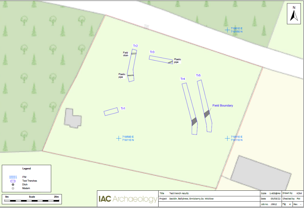
Archaeological testing was carried out on 1 March 2022 using a mechanical excavator fitted with a flat grading bucket. The trenches targeted open green space while broadly covering the site to fully investigate its archaeological potential.
The only feature identified in the course of this testing was a field boundary found in Trenches 4 and 5. This field boundary is orientated north-east/south-east and has a sharp break of slope at the top, steep sides and a gradual break of slope at base. The base was relatively flat. A heavy-duty blue plastic bag was seen at the base of this field boundary. It is probable that this is the field boundary seen in the 25-inch map although the alignment is slightly off, but this likely a result of increased accuracy in modern surveying. A shallow field drain was observed at the northern edge of Trench 2 whilst a service pipe (orange plastic pipe) was seen in Trenches 2 and 3 running north-east/south-west north of the gravel road and hardstanding present on site.