2022:098 - CHURCH HILL, Wicklow
County: Wicklow
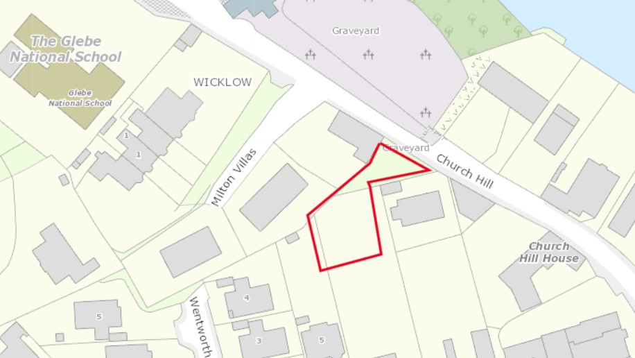
Site name: CHURCH HILL
Sites and Monuments Record No.: W1025-012, W1025-012003 and W1025-012004
Licence number: 22E0412
Author: Yvonne Whitty
Author/Organisation Address: Unit 10, Riverside Business Centre, Tinahely, Co. Wicklow
Site type: No archaeology found
Period/Dating: N/A
ITM: E 731250m, N 694208m
Latitude, Longitude (decimal degrees): 52.982525, -6.045382
Test trenching took place at a proposed single house development at Church Hill, County Wicklow. The site is located within an archaeologically-rich landscape and has remained a green field site since the time of the first edition map in 1836. Wicklow Town is of Viking origin and has evidence of settlement from the medieval period. The name is derived from the Scandinavian; either Vikingalo, ‘meadow of the Vikings’, or Vik-lo ‘meadow of the bay’.
Two recorded sites, WI025-012003, classified as a church and WI025-012004, a graveyard, are located across the road from the development site. A total of five other recorded sites are less than 300m from the site: WI025-012002, classified as a Franciscan Friary, WI025-012003, Wicklow Castle, WI025-012015, a medieval excavation and WI025-012001, a motte.
A total of three test trenches totaling 63m was excavated across the footprint of the development to determine the presence/absence of archaeological remains. No archaeology was found.
The entire site was covered with an organic-rich material 0.3m in depth which overlay 19th- and 20th-century debris (between 0.1–1.2m in average depth). Natural ground was consistent across the site comprising a mid-yellowish-brown silty boulder clay. It was exposed at varying depths; at the west part of the site, it was 0.3m below ground level and at the east part of the site adjacent to Church Hill it was 1.5m.