2022:044 - ATHLONE PEDESTRIAN AND CYCLEWAY BRIDGE, Westmeath
County: Westmeath
Site name: ATHLONE PEDESTRIAN AND CYCLEWAY BRIDGE
Sites and Monuments Record No.: WM029-042
Licence number: E005364, E005365, E005369
Author: Ian Russell, Archaeological Consultancy Services Unit
Author/Organisation Address: Unit 21, Boyne Business Park, Greenhills, Drogheda, Co Louth
Site type: Quay and Structure
Period/Dating: Modern (AD 1750-AD 2000)
ITM: E 603770m, N 741561m
Latitude, Longitude (decimal degrees): 53.424147, -7.943279
Archaeological monitoring under Ministerial Direction AR000081 was carried out at Wansboro Field, Athlone Marina/Radisson Hotel and Grace/Elliot Road on an intermittent basis between November 2021 and February 2022.
Monitoring at Wansboro Field (ITM 603588 742161), where a compound is to be located, was carried out in November 2021 and February 2022 (E005365). The entire area was stripped of topsoil under archaeological supervision. The works did not expose any archaeological features. The topsoil measured c. 0.25m and was removed onto natural orange clay.
Monitoring of engineering test pits was carried out at Athlone Marina/Radisson Hotel (ITM 603859, 741622) in November 2021 (E005364). In total, the excavation of four pits was monitored. The pits measured 2m in length by 1.45m in width with a depth of 1.25m. The stratigraphy exposed consisted of tarmac, hardcore and brown gravelly clay.
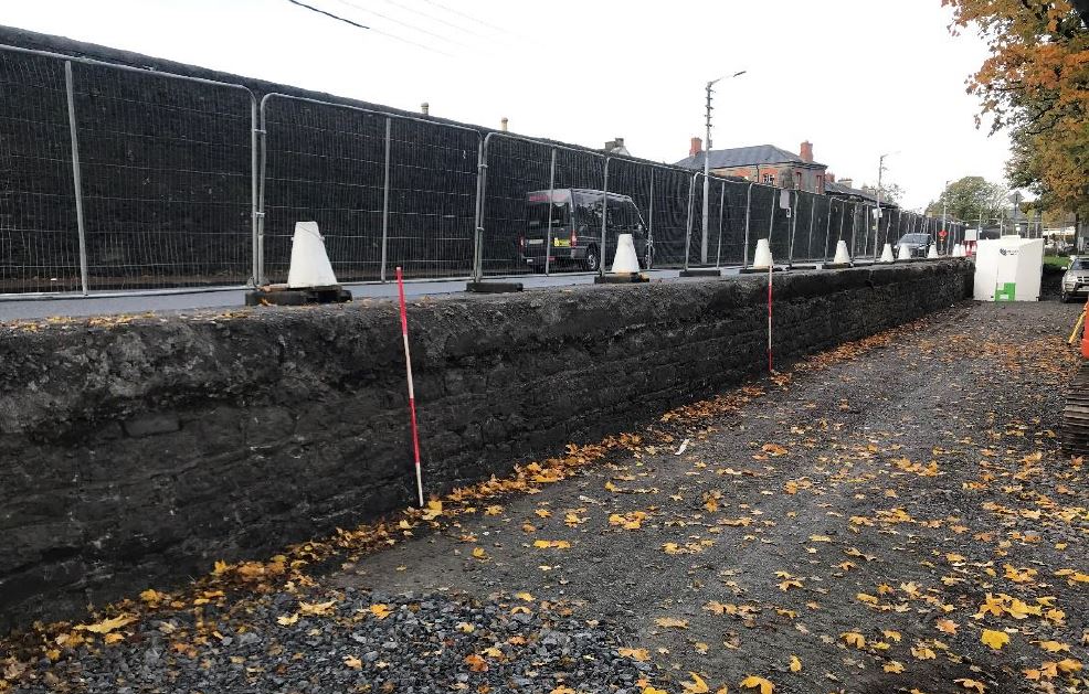
Monitoring at Grace Road/Elliot Road (ITM 603770, 741561) at the location of the proposed bridge piers was carried out in November 2021 (E005369). Three post-medieval walls were identified.
Following the removal of modern concrete capping, a portion of the original Victorian quay wall was exposed. To the south of the wall, a brown clay layer measuring c. 0.32m was found sealing natural orange clay. It was recorded by photography, written description and in addition, a 3D model of the wall, showing the stonework, pointing and cross-section, was carried out. A full topographical survey was carried out of any exposed portions of the river wall.
A second post-medieval mortared wall, was identified within the natural subsoil at a depth of 2–2.25m below the road surface. It measured 0.9m in thickness and appeared to be connected to a perpendicular return and collapse, which measured 0.6m in thickness and was interpreted as possibly representing a small structure.
The third wall was oriented north-west to south-east, measured 1m and was interpreted as representing an external boundary or ramp.
Archaeological monitoring was recommended during the removal of the temporary access ramp to record the remainder of the Victorian quay wall and will be carried out in due course.

