2022:475 - CURRAHEEN, Waterford
County: Waterford
Site name: CURRAHEEN
Sites and Monuments Record No.: N/A
Licence number: 22E0305
Author: András Hindli
Author/Organisation Address: Burnside, St. Oran's road, Buncrana, Co. Donegal
Site type: Burnt mound and Pit
Period/Dating: Multi-period
ITM: E 635745m, N 599566m
Latitude, Longitude (decimal degrees): 52.146785, -7.477722
A large programme of archaeological testing confirmed the presence of several potential previously unrecorded archaeological deposits within 46 of the excavated trenches, ranging in date from the prehistoric to post-medieval period. While conjectural in the absence of full excavation, the features within the townland of Curraheen include large-scale clusters of burnt mounds/fulachta fiadh, associated troughs and pits, hearth and potential structural features such as post- and stake-holes.
In order to spatially summarise the results of this programme, an ‘id’ number was assigned to each enclosed/individual field containing at least one archaeological feature. The following is a summary of the archaeological sites/features identified within the townland of Curraheen, County Waterford:
CH-01 (ITM 635724, 599027): in-situ burnt mound/fulacht fiadh composed of high concentration of calcinated stones and rich in charcoal deposits. The feature measured 11.7m north-south by 10m, however, it is likely extending beyond the limits of the trench to the west.
CH-02 (ITM 635503, 599093): a potential post-hole feature, measuring 0.3m in diameter, revealed a charcoal-rich fill and fragment of iron slag. In addition, a linear ditch-like feature was identified approximately 1m north of the potential post-hole, orientated east-west, containing a dark charcoal-rich fill and measuring 0.9m in width.
CH-03 (ITM 635570, 599422): a hearth, circular in plan, measuring 0.3m in diameter, consisting of scorched/heat-affected clay and traces of charcoal. Fragments of lithic debitage were identified during surface cleaning. An ex-situ broken rotary quern-stone was found during the ongoing programme of archaeological testing within the subject field (CH-03) (ITM 635657, 599501). The artefact was found on the ground surface near the eastern field boundary and was not associated with the excavated archaeological trenches. The eastern boundary of the field consists of a bank and stone wall, bounding an existing farm lane located at a lower height. The rotary quern-stone was located within this context, and it was very likely used as ‘construction material’ for the aforementioned wall.
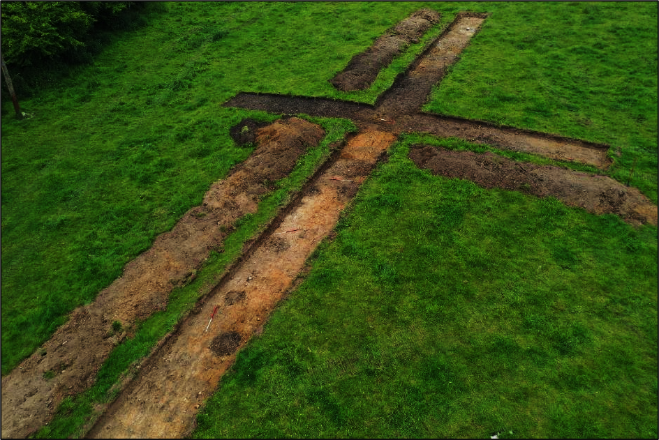
CH-04 (ITM centre point 635745, 599566): A cluster of seven burnt mounds of different dimensions (largest one being >24.5m x 15.5m) was identified within the north-eastern portion of the subject. It appears to be associated with evidence of a former stream that currently bounds this field to the east and north. These burnt mounds were substantial and were not excessively truncated or levelled. It was noted that, underneath the topsoil was a 0.05-0.1m thick layer of bright yellow compacted clay overlaying and masking the burnt mounds, which may have helped the preservation of these features. It is worthy of mention that immediately north of the former stream that bounds this field, another cluster of large burnt mounds, pits and potential troughs was identified (*CH-05).
CH-05 (ITM centre point 635737, 599710): A cluster of three burnt mounds/fulachta fiadh and at least seven pit-like/trough features were located within this field. These features were concentrated towards the western side of the field. The trenches also revealed possible evidence of a former streambed running north-south and located immediately east of the archaeological features. The most remarkable feature consisted of a well-preserved ‘horseshoe’-shaped burnt mound containing calcinated stones and very rich charcoal deposit, gradually diminishing eastwards. The burnt mound appears to extend beyond the western limit of the trench, towards the field boundary. The visible extent measured >17.3m x 9.6m. Immediately to the south a total of 7 oval and circular-shaped pits/troughs was identified spaced in a relatively equidistant matter. Further south within the field, a larger (2.5m in diameter) pit-like feature was also identified, containing a dark charcoal-rich fill with evidence of shattered stone inclusions (ITM 635740, 599681).
CH-06 (ITM 635481, 599759): Two potential post-holes were identified within this field. Both were circular in plan, measuring between 0.25m and 0.3m in diameter, 1.4m apart, lying north-west/south-east. Both features presented a charcoal-rich fill. The southernmost feature revealed a flint lithic artefact and evidence of stone-packing during surface cleaning.

