2022:586 - SLIGO: Tobergal Lane, Knappagh Beg, Sligo
County: Sligo
Site name: SLIGO: Tobergal Lane, Knappagh Beg
Sites and Monuments Record No.: SL014-065
Licence number: 21E0848
Author: Zbigniew Malek, Archaeological Management Solutions
Author/Organisation Address: Fahy’s Road, Kilrush, Co. Clare
Site type: Town
Period/Dating: Post Medieval (AD 1600-AD 1750)
ITM: E 569084m, N 835936m
Latitude, Longitude (decimal degrees): 54.271296, -8.474633
Archaeological monitoring of groundworks was undertaken for Tobergal Lane Water Mains Scheme in Sligo town. Tobergal Lane is situated between O’Connell Street to the southwest and the River Garvoge or Garavogue to the northeast located within the historic town of Sligo (SL014-065). The monitoring was carried out intermittently between 18 January and 1 March 2022.
The groundworks for the scheme consisted of a continuous open-cut trench which measured in total approximately 79m long, 0.4–1.3m wide and 0.7–1.0m deep. The natural subsoil was revealed only in the south-western end of the trench, decreasing towards the northeast. A layer of riverine peat was found in the north-east section of the trench. These layers were underlying the reclamation layers which were present in the trench for almost its entire length and based on the finds recovered, seemed to be built up over time since the seventeenth century.
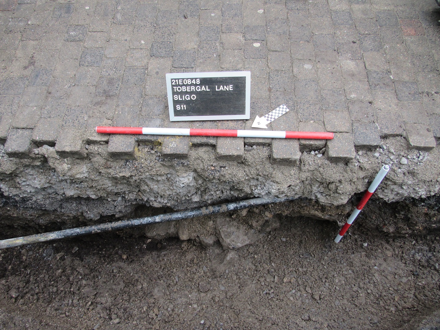
In total, eleven stone structures (S1–S11) were revealed within the trench, ten of which (S1–S9 and S11) were partially disturbed by the previous groundworks. The structures comprised two stone culverts (S9 and S8) and remnants of culverts (S1–S3, S5 and S7), two stone wall foundations (S10 and S11), one possible wall footing (S4) and one structure of unknown purpose (S6). All stone structures were probably cut into the reclamation layers; however, no cuts associated with these structures were noted.
Stone culverts (S8 and S9) and remnants of culverts (S1–S3 and S5) were revealed within a 48m long section of the exploratory trench, along its north-west side. S9 was found at a depth of 0.64m below ground level (BGL) and was orientated east-west. It measured 1.6m long (east-west), 0.9–1.0m wide, 0.78m high. It comprised two parallel dry stone walls covered with large angular shale capstones. Located approximately 9m to southwest of S9 was culvert S8. This was unblocked, had flowing water and was preserved in situ.
Two stone wall foundations (S10 and S11) were revealed 5.2m from each other, within the trench in the north-east end of the lane. Stone wall foundation S10, orientated north-south, was found at a depth of 0.54m BGL and measured 0.7m long (north-south), 0.7m wide and 0.56m high. It corresponds with a side wall of a narrow lane leading from 14 Grattan Street towards the river, as seen on the Ordnance Survey Sligo Town Plans (1837 and 1875). This lane still exists; however, it has been realigned since Tobergal Lane was redeveloped in the 1990s. Stone wall foundation S11, orientated north-west/south-east, was found at a depth of 0.42m BGL and measured 0.5m long (north-west/south-east), 1.3m wide and 0.6m high. This substantial mortared foundation does not correlate with any walls on the abovementioned Town Plans but can be dated to the post-medieval/modern periods.
The assemblage of finds recovered from the reclamation layers at Tobergal Lane, which consisted of pottery sherds, green vine glass bottle shards and fragments of stone roof tiles, is typical for post-medieval and modern urban sites across Ireland. Occasional animal bones and frequent oyster shells were noted in those layers.