2022:670 - NOBBER: St John’s Graveyard, Meath
County: Meath
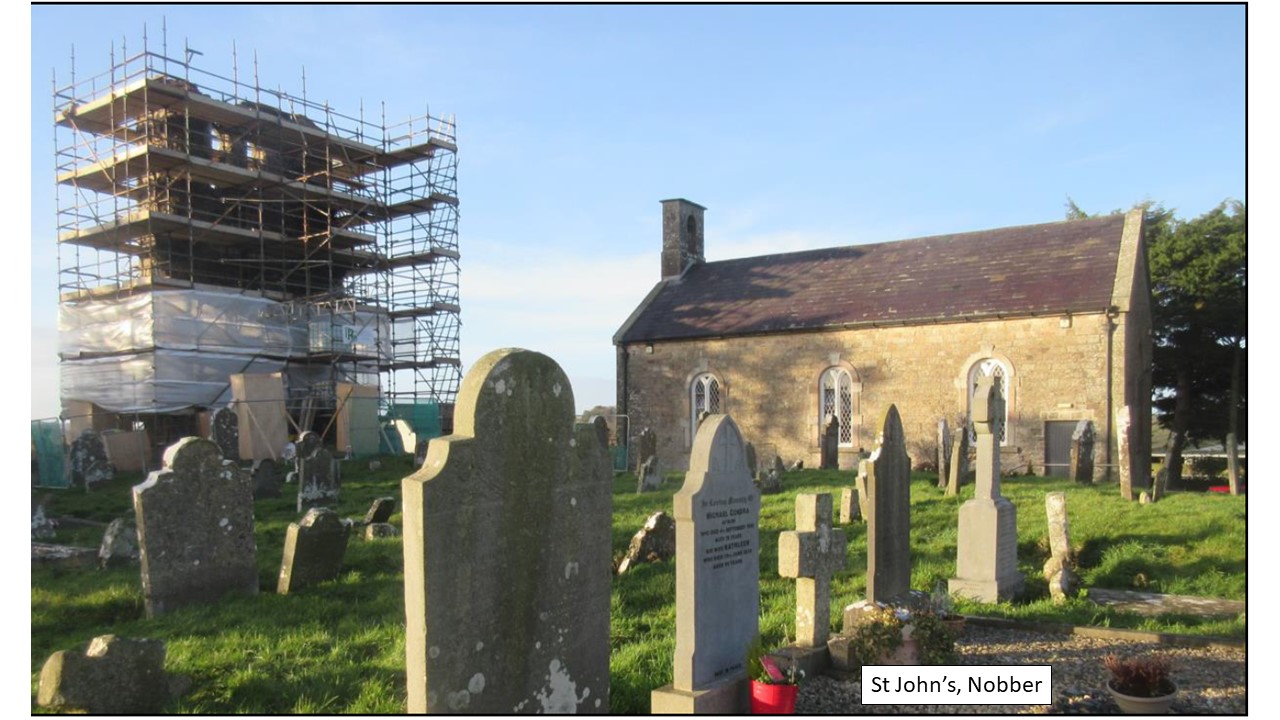
Site name: NOBBER: St John’s Graveyard
Sites and Monuments Record No.: ME005-071
Licence number: 22E0725
Author: Niall Roycroft
Author/Organisation Address: C/o Meath County Council
Site type: Building
Period/Dating: Late Medieval (AD 1100-AD 1599)
ITM: E 682376m, N 786476m
Latitude, Longitude (decimal degrees): 53.821266, -6.748901
Meath County Council applied for a Community Monuments Fund (CMF) grant for works on the standing remains of the 15th-century, 14.6m high tower of the Church of St John the Baptist, ME005-071001, Nobber, County Meath.
The work that took place to Area 1: take down a 6m length of 18th-century terrace retaining wall that needed to be rebuilt. Also to monitor ivy removal and spoil clearance to expose in-situ masonry from the previously demolished section of the north wall (Area 2) and south wall (Area 3) of the tower. Areas 2 and 3 were to allow for new supporting wall buttresses to be constructed.
The natural soils of the knoll on which St John’s was built was overlain by a fairly clean layer that was capped with a deposit that includes lenses of burnt charcoals and sands. This layer was covered with a deposit of powdery white-grey plaster or lime which was perhaps associated with the construction of the adjacent 15th-century tower. The west wall of the tower was 6.5m wide and the tower was presumed to be square in plan. It had six discussion levels:
Level 1 was a lower floor 3m square and approx. 2m high with walls 1.6m thick. There was a window in the middle of the south wall. The top of this room is seen by a step and this is current ground level. Level 2 included a stone barrel vault (springers 1.75m above the step and apex 3m above step). There is a window in the middle of the west wall. The vault was 0.5m thick and formed the Level 3 bell-ringers’ floor. The Level 3 room was internally 4m square x 2.42m high and the walls were reduced to 1.15m thick. There is a finely carved, ogee-headed window in the west wall and the ceiling was supported by a large (0.35m square) putlog beam. The Level 4 room was 4.14m square x 2m high. There is a simple pointed arch window in the west wall.
Level 5 was the belfry level, and the floor was on another step in the wall making the room around 4.5m wide and approx. 3m high. A pair of belfry windows 2.7m high x 0.92m wide, separated by a column 0.5m wide in the west wall. Internally the windows are flat and lintel-headed, but externally they have simple two-piece pointed arches (arch heads c.0.46m high). A jamb for a belfry window was also recorded in the south wall and the north wall but these were not directly opposing. The ceiling to Level 5 was supported on a series of beams set into the walls and Level 6 was an externally projecting drip course (0.1–0.15m) that was anchored in place by a stone-built cornice up to 1m high, which was pierced by a series of weep-holes for roof drainage. The roof is represented by large sandstone slabs, the largest of which is 1.17m x 0.72m x 0.1m thick. The others are more in the region of 0.8m x 0.7m. The slabs are set at a shallow angle (perhaps 20o) to provide a probably pyramidal roof without an obvious rooftop walkway.
Once the Tower was built a graveyard adjacent to it and a lack of tower doors indicate that it was probably a stand-alone belfry tower that doubled as a general watch-tower over the surrounding countryside. Three graves were noted in the section for Area 1 and they were retained in situ. These had been cut by the construction of the 18th-century retaining wall for the present graveyard. At this time the Tower was carefully demolished with the remaining wall being deliberately left as a folly and local landmark (the new church is rather low).
Subsequently, a series of grave rows were laid out which avoided the buried remains of the tower foundations. However, graveyard pressure meant that three c.19th-century graves exposed in Area 3 had been dug through parts of the tower’s south wall. These were only excavated to project level and any articulated inhumations in them were left in situ. Modern graveyard soils included midden material such as food waste (animal bones, bird bones and cockle shells), modern pottery, a partially completed die (made of horn), a broken iron knife, clay tobacco pipe, some iron nails and modern pottery. Around 120 fragments of disarticulated human bone were collected during the excavation and these represent both adults and juveniles probably dating from the 15th/16th to 19th century. These will be briefly analysed and then reburied on site.
Some interim scans of the tower are available at:
https://poly.cam/capture/3C41FC0E-02C9-4074-B6A7-27224BFC3264
https://poly.cam/capture/D153E32E-5083-4630-B5DC-70A6DA2ABE5D
https://poly.cam/capture/AA14443D-F9FD-4E29-BEEC-74A710BB2CE1
https://poly.cam/capture/4C1F59E4-D141-4459-A6BF-DB6F1DE6F444