2022:503 - LISCARTAN, Navan, Meath
County: Meath
Site name: LISCARTAN, Navan
Sites and Monuments Record No.: N/A
Licence number: 22E0779
Author: Fergal Murtagh, c/o IAC Archaeology
Author/Organisation Address: Unit G1 Network Enterprise Park, Kilcoole, Co. Wicklow
Site type: Enclosure
Period/Dating: Multi-period
ITM: E 683499m, N 769552m
Latitude, Longitude (decimal degrees): 53.669039, -6.736421
Geophysical survey carried out under licence 22R0354 by Joanna Leigh of J. M Surveys Ltd revealed a possible L-shaped boundary ditch feature extending from the western site boundary for c. 180m and turning northeast for c. 200ms. The feature runs through a small rectilinear enclosure with an internal curvilinear response, which may represent habitation activity.
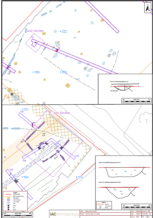
Testing identified two areas of archaeological potential within the proposed development area. The largest area of activity is located within AA1, which consists of a probable rectilinear enclosure measuring 25m x 20m along with an internal circular feature of c.7m diameter. No diagnostic material was recorded during testing and whilst the circular feature may be prehistoric in date, the rectangular enclosing element would be more unusual for this period. It remains possible that the two features are not contemporary with one another.
AA2, located c.190m to the east of AA1 comprised a small pit possibly associated with unidentified prehistoric burnt mound activity.
The large ditch running through the proposed development area was also assessed with test trenches. Whilst the ditch was relatively wide (2m), its depth was shallow in comparison. No diagnostic material was recovered from the feature, but it has been interpreted as a field boundary or drain, which went out of use when the demesne landscape was created in association with Liscartan Castle.

