2022:406 - TALLANSTOWN: Glyde Road, Louth
County: Louth
Site name: TALLANSTOWN: Glyde Road
Sites and Monuments Record No.: N/A
Licence number: 22E0636
Author: Jane Whitaker, c/o IAC Archaeology
Author/Organisation Address: Unit G1 Network Enterprise Park, Kilcoole, Co. Wicklow
Site type: Burnt mound
Period/Dating: Prehistoric (12700 BC-AD 400)
ITM: E 695565m, N 797681m
Latitude, Longitude (decimal degrees): 53.919667, -6.545168
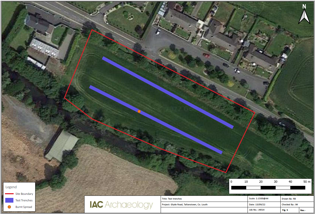
Archaeological testing was carried out on 2 September 2022 using a mechanical excavator fitted with a flat grading bucket to study the impact, if any, on the archaeological and historical resource of the proposed development. Two test trenches, measuring 200 linear meters in total, were excavated, targeting open green space to fully investigate the archaeological potential of the site.
A single burnt mound was the only archaeological feature recorded within the two test trenches. It was located 37m from the north-north-west extent of Trench 2 and measured 3.74m x 2.35m in size and had a minimum depth of 0.25m. The trench was extended by 4m to the west to reveal the full extent of the feature. Once recorded and photographed the feature was covered with black plastic and backfilled along with the test trenches.