2022:401 - ARDEE: Jervis Street, Louth
County: Louth
Site name: ARDEE: Jervis Street
Sites and Monuments Record No.: N/A
Licence number: 22E0050
Author: Muireann Ni Cheallachain, c/o IAC Archaeology
Author/Organisation Address: Unit G1 Network Enterprise Park, Kilcoole, Co. Wicklow
Site type: Historic town and Town defences
Period/Dating: Multi-period
ITM: E 695932m, N 790551m
Latitude, Longitude (decimal degrees): 53.855549, -6.541814
Archaeological testing was undertaken to study the impact, if any, on the archaeological and historical resource of a commercial development, which is located at Jervis Street, Ardee, Co. Louth.
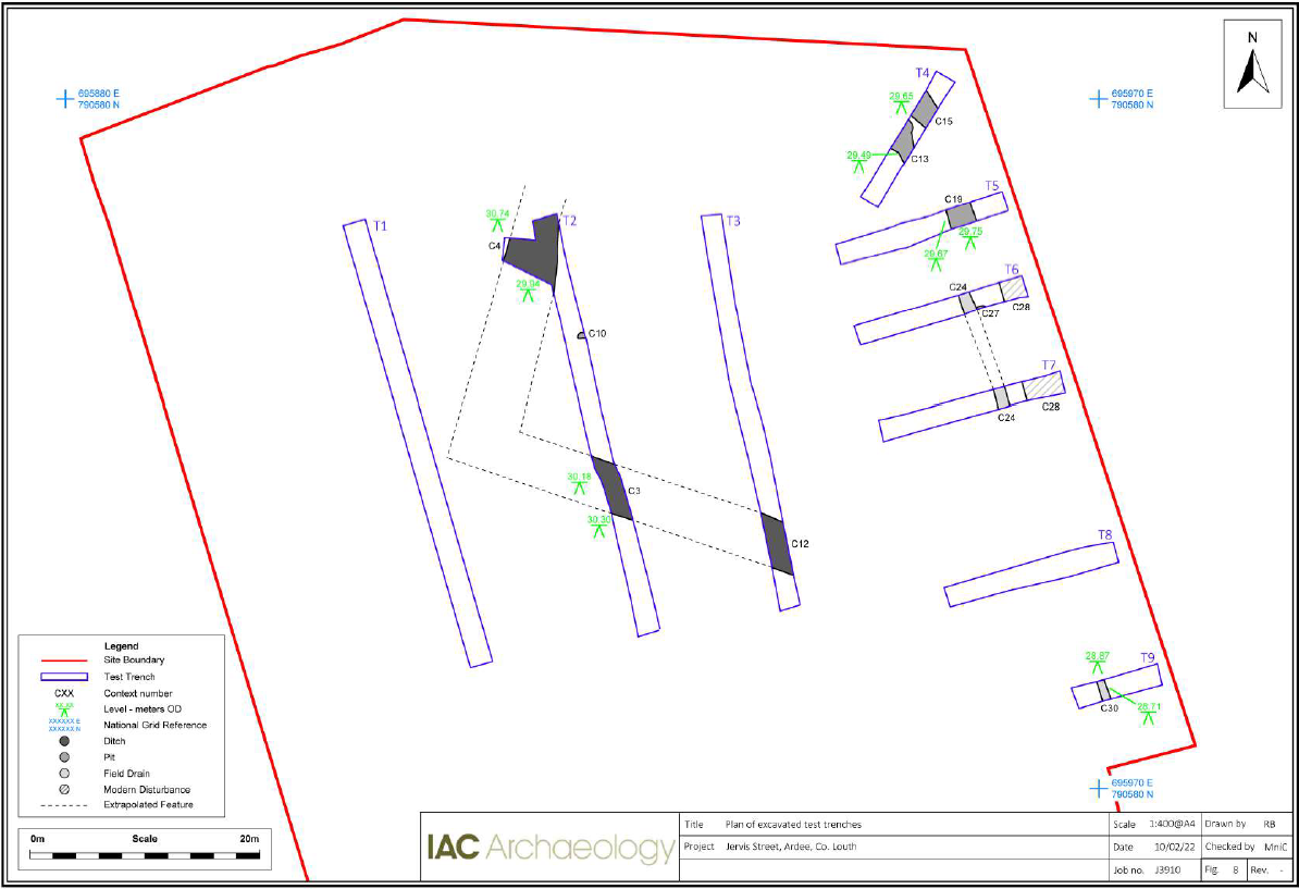
Testing was carried out in January 2022. A total of nine trenches were mechanically investigated across the test area which measured c.195 linear metres in total. Six of the trenches focused on the eastern side of the site (along the line of the medieval town wall) and in the north-eastern corner, in the vicinity of the medieval Ask Walk Gate. Three trenches were also excavated within the central courtyard, to confirm the level of disturbance by previous development
There was no evidence of any upstanding stone walls in the six trenches dug across the line of the projected town wall within the development area. Only two pit features of probable medieval date were recorded along with several possible pit and drainage features of probable post-medieval date. The artefactual and ecofactual material identified in the larger medieval pit, including ceramics, leather, charcoal and butchered bone, represents typical medieval domestic waste. While no upstanding remains of the medieval town walls are known within the site location or its immediate vicinity, excavations along the projected town wall directly to the north identified three parallel north–south aligned stone walls representing different phases of the medieval town wall construction along with several medieval ditches (O’Neill & O’Connell 2005: 03E1045). Due to its placement and alignment, it must be noted that the linear post-medieval drain/ditch feature recorded in several of the eastern trenches may represent a robbed-out and re-used wall foundation trench, possibly similar to of one of the phases of town wall construction identified in previous excavations to the north. The stone and mortar layer that sealed the larger medieval pit in Trench 5 may also represent the material deposited from the robbing/disturbance of the town wall foundations.
The construction of an artillery bastion outside (west of) the town wall to the north of the development site indicates that the defences were considerably remodelled in the 17th century and evidence of an embankment was recorded in the archaeological investigations c. 25m to the north (Licence Ref: 03E1045). The presence of post-medieval activity in the eastern and north-eastern trenches may represent some activity associated with post-medieval remodelling of the town defences.
A large ditch identified in two test trenches in the courtyard area of the development probably represents a post-medieval field boundary or drainage ditch which may be associated with the Demesne of Ardee House.
The presence of modern disturbance recorded along the eastern extent of the development site suggests that many of the features associated with the medieval and later 17th-century town defences may no longer survive within the development area.