2022:333 - DROGHEDA: North Road, Louth
County: Louth
Site name: DROGHEDA: North Road
Sites and Monuments Record No.: LH024-091
Licence number: 22E0752
Author: Declan Moore
Author/Organisation Address: 3 Gort na Rí, Athenry, Co. Galway
Site type: Burnt spread and Pit
Period/Dating: Undetermined
ITM: E 707674m, N 776732m
Latitude, Longitude (decimal degrees): 53.729118, -6.368235
The author was commissioned by the client to complete a cultural heritage assessment on the potential impact of a proposed residential development at Moneymore, North Road, Drogheda, Co. Louth, and subsequent archaeological testing at the site. The Proposed Development Area (PDA) is a greenfield site to the north of an old stone quarry along the R132 south-east of the Rosehall Roundabout. The application which is the subject of this report is for a Phase 1 development of 98 residential units in the western part of the overall landholding. The build-out of the remaining lands in the overall landholding will be addressed at a later date and an updated report will be prepared for follow on phases if, and when, they develop.
The Archaeological Survey of Ireland records a ring ditch (LH024-091—) to the north-east of the property. This monument was originally identified in a gradiometer survey (18R0118) of an adjacent development area. The feature is on the bend of a lane depicted on the OS first edition map.
A geophysical survey of the overall landholding was undertaken between 17 and 26 May 2022 by Donald Murphy, Rob Breen, and Jeanne Rochford of Archaeological Consultancy Services Unit Ltd. (ACSU) under licence 22R0166.
No definite signs of archaeology were identified; however, several possible linear features, and small and large anomalies of potential archaeological significance were noted.
To fully assess the site test trenching was recommended by the author targeting the anomalies identified. The testing was carried out at the location of the proposed development and in the wider landholding.
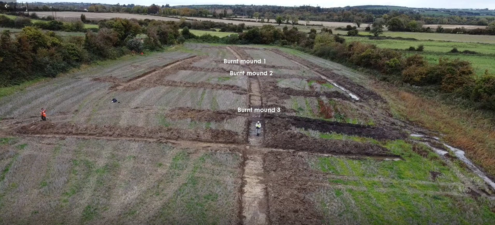
The programme of archaeological testing was carried out on 23 and 24 October 2022 by the author and an assistant. The excavation work was carried out using a 20-tonne backhoe wide track excavator with a 2m wide grading bucket.
Testing exposed five previously unknown archaeological features (three burnt spreads and two pits of indeterminate date) in the easternmost field (outside of the area proposed for development but within the overall landholding) in an area of low-lying ground within test trench 3. These features lie outside the current application area and will not be directly impacted upon by the currently proposed works.