2022:072 - KILBRICKAN, Mountrath, Laois
County: Laois
Site name: KILBRICKAN, Mountrath
Sites and Monuments Record No.: N/A
Licence number: 22E0224
Author: Grace Fegan; Shanarc Archaeology Ltd.
Author/Organisation Address: Unit 39A, Hebron Business Park, Hebron Road, Kilkenny
Site type: Burnt spread
Period/Dating: Undetermined
ITM: E 636498m, N 689446m
Latitude, Longitude (decimal degrees): 52.954554, -7.456837
Archaeological test excavations were conducted as part of an Archaeological Impact Assessment in relation to the planning requirements (Planning Ref. 21/110) for the proposed provision of new agricultural buildings at Kilbrickan, Mountrath, Co. Laois.
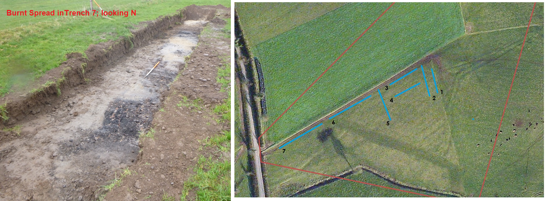
Seven test trenches were excavated within the proposed development area. Trenches measured between 20–45m in length and 2m in width. The sod layer measured between 0.2–0.45m deep. The topsoil layer comprised a mid- to dark brown clayey silt; this was found throughout the proposed development site. The natural subsoil layer comprised mid-orange-brown friable silty sand.
A spread of burnt mound material was exposed within Trench 7, comprising charcoal-rich sandy silt with frequent small-medium heat-shattered stone. This spread appears to correspond to a dark feature visible in the OSi aerial mapping, where it is not apparent whether the feature represents water or recent burning. No such surface feature was visible during the field inspection or during test trenching. The spread of material was cut by drainage features and contained no modern objects.
No finds or features of archaeological interest were noted in Trenches 1–6.