2022:651 - HAGGARD AND PARKSTOWN UPPER, Kilkenny
County: Kilkenny
Site name: HAGGARD AND PARKSTOWN UPPER
Sites and Monuments Record No.: KK040-014
Licence number: Unlicenced Monitoring
Author: Fiona Reilly; Shanarc Archaeology Ltd.
Author/Organisation Address: Unit 39a, Hebron Business Park, Hebron Road, Kilkenny
Site type: No archaeology found
Period/Dating: N/A
ITM: E 663166m, N 623132m
Latitude, Longitude (decimal degrees): 52.356128, -7.072707
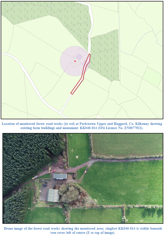
Unlicensed archaeological monitoring was carried out on 17 February 2022, in relation to excavations associated with the upgrading of an existing farm access road to facilitate harvesting at an existing Coillte forest block in Parkstown Upper, Co. Kilkenny.
The road upgrade works took place partly in Parkstown Upper and partly in Haggard, the adjacent townland to the south. The works were carried out under Forest Road Licence CN85472 issued by the Department of Agriculture, Food and the Marine; archaeological conditions required all groundworks within 100m of a recorded monument, ringfort KK040-014, to be subject to archaeological monitoring by a suitable qualified archaeologist; ringfort KK040-014 being sited on the townland boundary between Parkstown Upper and Haggard.
The scope of works largely involved the removal of soil build-up above a previously metalled surface on an existing farm access track, measuring approximately 4m in width, with the removal of the previously laid limestone gravel. A marginal amount of topsoil, 0.4m from the west side of the road, was excavated in places. It is intended to place a new layer of crushed stone (400mm of 804 gravels) on the “cleaned-down” road surface to form the upgraded forest access road surface.
Nothing of archaeological interest was noted during archaeological monitoring, either associated with monument KK040-014, or with other previously unknown archaeological activity.

